The CC Trig Point bagger thread, now incorporating other interesting geographs

Page may contain affiliate links. Please see terms for details.
Saturday 29th
5.

Heath Hall
Heath (conservation village)
Wakefield

IMG_3931.jpeg


IMG_3932.jpeg


https://britishlistedbuildings.co.uk/101200238-heath-hall-warmfield-cum-heath#google_vignette
https://britishlistedbuildings.co.u...-west-front-of-heath-hall-warmfield-cum-heath
https://wakefieldvistas.wordpress.com/2019/07/21/heath-village-of-the-mansions/
Some more history; https://www.geograph.org.uk/photo/1936830
 
Last edited:
 
Tuesday 1st
1

Church Of St Peter Gates
Stanley
Wakefield

As seem from Aberford Road/A642
It wasn't an old Church, being rebuilt just before WW1, but mining subsidence was its (quite literal) downfall
(mining, footwear & rhubarb/market gardening, were 3 of the big local employers

We were taking my mother shopping, so once more I walked part-way with the dog


IMG_3957.jpeg


https://en.m.wikipedia.org/wiki/St_Peter's_Church,_Stanley,_West_Yorkshire

The Church can be seen, it was probably already closed/decommisioned by then; https://www.geograph.org.uk/photo/2935303
 
Last edited:
Tuesday 1st
4.

Church Of St Peter Cemetery
Stanley
Wakefield

Looking northwards, towards Lake Lock Road
The 3 buildings just beyond the hedge (on 'LLR') are associated with the long-established local funeral director, the steep white 'gable-end', being their Chapel of Rest
The Wesleyan Methodist Chapel, on Mount Road, can be seen (large building), it's now in private hands, & being converted into a house/flats
(more photos/information)

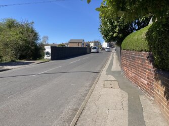
IMG_3970.jpeg


This gravestone used to have a carved Anvil on top

IMG_3971.jpeg


The gates, at Lake Lock Road

IMG_3972.jpeg


The gates, with Bells Funeral Director showing, at the junction with Mount Road; https://www.geograph.org.uk/photo/7755958
When the Anvil was still in place; https://www.geograph.org.uk/photo/1001359
 
Last edited:
Tuesday 1st
5

St Peters Infant School
Stanley
Wakefield

It was the School, now home to a playgroup, there's a Sunday Service, & the groups that used the (demolished) Church meet here

IMG_3973.jpeg


Behind it runs one of the local 'wagon-ways', from collieries, to a loading staith on the (previous alignment of (what became) the Aire & Calder Navigation Canal (parts are stll in water, but as simply fishing ponds)
Now a public footpath, to cut a corner from Mount Road, to Aberford Road

https://www.geograph.org.uk/photo/499339
https://www.geograph.org.uk/photo/4321807
 

Attachments

  • IMG_3974.jpeg
    IMG_3974.jpeg
    304.3 KB · Views: 0
Last edited:
There might be a few additions from around the Barnsley area tomorrow, as I have to take the trailer & help friends of ours to empty there 'self-storage' unit
I'll be passing through Barnsley itself, along the A61, to Worsborough
Passing what was a level-crossing, on the old 'Woodhead Line', a canal basin, & what used to be the home of a Planet X shop, plus passing the obelisk at Birdwell
 
Last edited:
Top Bottom