Richard A Thackeray
Legendary Member
Locomotives
John O'Gaunts
('top end' of) Rothwell
Along the A639 Pontefract Road, which becomes Leeds Road (& crosses jct 44/M1)
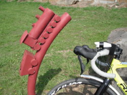
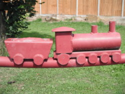
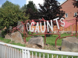
They're all along the red scroll-work
https://www.geograph.org.uk/photo/3589780
The 'East & West Yorkshire Union Railway' went under Pontefract Road here, to service Rothwell Haigh (aka Fanny Pit) Colliery, via a spur
https://maps.nls.uk/geo/explore/#zoom=15&lat=53.7635&lon=-1.4801&layers=10&b=1
Scroll down to Rose Pit, for the topic photograph
(Rose & Fanny/Francesca being the daughter of one of the owners)
John O'Gaunts
('top end' of) Rothwell
Along the A639 Pontefract Road, which becomes Leeds Road (& crosses jct 44/M1)


They're all along the red scroll-work
https://www.geograph.org.uk/photo/3589780
The 'East & West Yorkshire Union Railway' went under Pontefract Road here, to service Rothwell Haigh (aka Fanny Pit) Colliery, via a spur
https://maps.nls.uk/geo/explore/#zoom=15&lat=53.7635&lon=-1.4801&layers=10&b=1
Scroll down to Rose Pit, for the topic photograph
(Rose & Fanny/Francesca being the daughter of one of the owners)
Last edited:

