The CC Trig Point bagger thread, now incorporating other interesting geographs

Page may contain affiliate links. Please see terms for details.

Tail End Charlie

Well, write it down boy ......
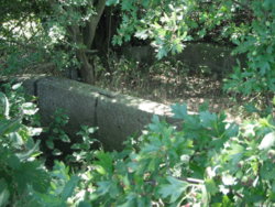
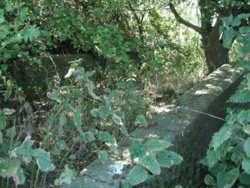
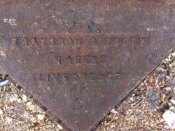
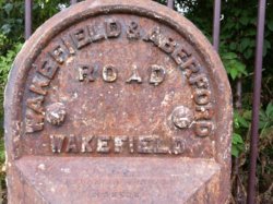
From today's ride, not sure if a bench mark or a piece of graffiti? It's near Davenham near Northwich on a bridge over the river Dane. Nice spot though whatever it is.
20180712_140054.jpg
20180712_140100.jpg
 

Bobby Mhor

Guru
Location
Behind You
From today's ride, not sure if a bench mark or a piece of graffiti? It's near Davenham near Northwich on a bridge over the river Dane. Nice spot though whatever it is.
View attachment 419077 View attachment 419078
@Tail End Charlie

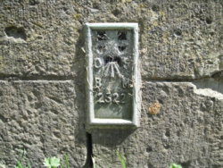
This may be it?
HERE
Untitled.jpg
 
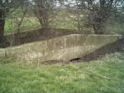
(quite literally ) Stamford Bridge
On the A166, about 7 miles north-east of York

This is on the base of the bridge on the down-stream/town-side of the bridge, only just uncovered (there's a flood bank being built up
I only spotted it by chance, as I was looking for the bench-mark

DSCF5618.JPG

It's located on the extreme far right of the bridge; https://www.geograph.org.uk/photo/9390
 
Last edited:
Here's one that some, even in Tadcaster (less than a mile away), don't know about

Kettleman Bridge
It spans a (now) underground stream.

Standing at the confluence of the River Wharfe & Cock Beck, just downstream of Tadcaster. This bridge was in existance circa 1400.
It was partially buried under new flood control embankments that were built up in the 1970's.
Up to 1965 it span a loop of Cock beck before it joined the Wharfe. There was once a stone built staithe here where quarried stone was probably transported to York

Surprisingly, it's not even on 'Geograph', or 'British Listed Buildings'
This shows the location though (in central blue 1km square)
https://www.geograph.org.uk/photo/1611159

This afternoon...……….
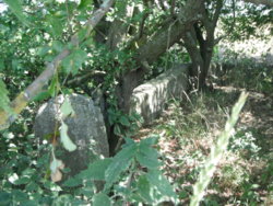
DSCF5629.JPG DSCF5631.JPG DSCF5634.JPG


April 2004...……………….
North Yorkshire Scenes. Tadcaster. Kettleman Bridge 1.JPG
 
Last edited:
(quite literally ) Stamford Bridge
On the A166, about 7 miles north-east of York

This is on the base of the bridge on the down-stream/town-side of the bridge, only just uncovered (there's a flood bank being built up
I only spotted it by chance, as I was looking for the bench-mark

View attachment 419487

It's located on the extreme far right of the bridge; https://www.geograph.org.uk/photo/9390

I did try to find the mark on the bridge itself, but there's been some new stone-work, and a few flakes/impact damage, so sorry
 
Last edited:
Top Bottom