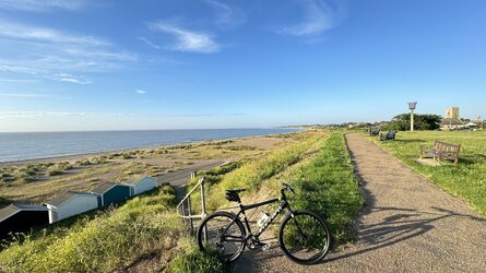
Share a photo that sums up your cycling today

Page may contain affiliate links. Please see terms for details.

avecReynolds531

Veteran
Location
Small Island
DSC05481.jpg
 

sevenfourate

Devotee of OCD
I love living close to the coast. I try to grab a view of the sea as often as I can when cycling. It often defines my route…..
 

Attachments

  • IMG_4395.jpeg
    IMG_4395.jpeg
    198.6 KB · Views: 14
IMG_2224.JPG
This was my Wednesday ride through the Ribble vally, over to Chipping and back to burnley.
 

Brandane

Legendary Member
Location
Costa Clyde
20240729_130623.jpg


I don't care if it's only 100 YARDS to Maybole, NO WAY am I cycling on the main A77 trunk road between Girvan and Ayr, at a point where it is single carriageway with one narrow lane in each direction, and absolutely no verge. Whoever did the risk assessment for this and then decided it was suitable to be classified as some sort of approved cycle route needs a good talking to. He or she is not a cyclist!
This was at a point where after several miles of roller coaster hills on quiet back roads, "route 42" suddenly spits you out at a T junction onto the A77. Just crazy.
 
Monday 29th

Part of my route home from work at about 14:20
Sometimes if it’s light enough l’ll ride this way & through NewLands Woods

Alongside the River Calder (upstream), after joining it at ‘Stanley Ferry’ (where the Aire & Calder Navigation Canal crosses it on an Aquaduct)

It’s an old railway route, from (the long gone) St Johns Colliery to loading staithes/slipway for the ‘Tom Puddings’

IMG_0943.jpeg


The Grade 1 listed Aquaduct

If you look at the OS map below the image, you can see the ‘dismantled railway’ route
The red road (Aberford Road/A642) is;
South-west = Wakefield
North-east = jct 30/M62
https://www.geograph.org.uk/photo/6929731


This is a ‘Tom Pudding’, once in the water, they were chained together (7 or 8?) & towed all the way to Goole, where they were bodily lifted out of the water & tipped into waiting vessels
Hence I followed the line as it 'exits stage left'
IMG_0946.jpeg
 
Last edited:

gtmet

Über Member
Location
Bristol
Monday 29th

Part of my route home from work at about 14:20
Sometimes if it’s light enough l’ll ride this way & through NewLands Woods

Alongside the River Calder (upstream), after joining it at ‘Stanley Ferry’ (where the Aire & Calder Navigation Canal crosses it on an Aquaduct)

It’s an old railway route, from (the long gone) St Johns Colliery to loading staithes/slipway for the ‘Tom Puddings’

View attachment 739177


The Grade 1 listed Aquaduct

If you look at the OS map below the image, you can see the ‘dismantled railway’ route
The red road (Aberford Road/A642) is;
South-west = Wakefield
North-east = jct 30/M62
https://www.geograph.org.uk/photo/6929731


This is a ‘Tom Pudding’, once in the water, they were chained together (7 or 8?) & towed all the way to Goole, where they were bodily lifted out of the water & tipped into waiting vessels
Hence I followed the line as it 'exits stage left'
View attachment 739182

Pedantic comment: in the era shown they were pushed by steam tugs. Towing came with diesel tugs.
Official name: Compartment boats.
 
Top Bottom