Your ride today....

Page may contain affiliate links. Please see terms for details.

Supersuperleeds

Legendary Member
Location
Leicester
Since today was forecast to be nice weather wise I booked the day off work and did an explorer square ride up to Lincoln, if everything went right I'd get my max cluster all the way to Lincoln.

Planned route was 115 miles but I had options to reduce this to 110 depending on how I decided to bag some squares on the A52, also had an extra 7 miles up my sleeve if I felt like doing them at around 80 miles.

Anyway set off just before 06:00, arm warmers on and a thin top over the SS top. Warm enough to start off in shorts though. arm warmers and top came off after a couple of hours.

Quickish 30ish miles to the edge of the A52 squares and I spot a bridleway going into the first square that I need, so divert up that, it might have been a bit bumpy :rolleyes:

Up to the A52 and I decide to do the two miles down it instead of the here there and everywhere route I originally planned. It was fine, traffic gave me loads of room and I was soon off it with no incidents. Knocked about 4 miles off the route.

Then up to Coddington on the outskirts of Newark, went into a farm road only to find it padlocked, so decided to find another route, found the track that @wajc mentioned to me previously and grabbed another square.

Then onto the key squares of the day, unfortunately the most important one was on a military firing range and the red flags were flying so missed out on it, gives me an excuse to go back, subsequently I've worked out I can get six squares just North of this one quite easily and they will take my max cluster to Lincoln.

A few more horrendous bridleways, some pot holed to hell, others very muddy and some both! Ended up doing the extra 7 miles, which turned out to be nearer 10!

When I got to Bardney and the cafe stop I noticed I had split the rear rim, not a crack but a full on tear in it. I gave it a push and it felt solid so risked carrying on.

Managed to get to the train station okay and home, took the wheel into the LBS and he was impressed (I'm known as the bike destroyer at my lbs) Also told me the rim was that worn it would have needed replacing anyway. so going to take the front wheel in tomorrow so he can do that one as well.

Ended up doing 122 miles, if it wasn't for the rim I would have done the extra 2.5 to take it to a double metric, though I did do 3 miles from the station to home and another mile going to the LBS, so I bagged the double metric for the day ^_^

https://www.strava.com/activities/1549326069
 

Donger

Convoi Exceptionnel
Location
Quedgeley, Glos.
Cwm Nantcol is lovely and there are some fabulous views out over the sea from the hills up there.

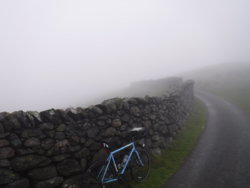
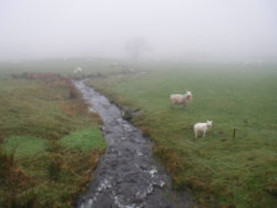
Not today there weren't! Foggy as hell today, and this shot was typical ...
102 Cwm Nantcol.JPG

Made for a bit of an adventure, actually. I got off the main road earlier than originally planned, just to feel safe in the mist. That meant taking a little road from Llanbedr that cut across from the Bychan valley to the Nantcol valley, and boy was it a shock. Quite a punchy little climb straight away that forced me to dismount briefly within the first half mile of climbing. Then, when back on the bike, the higher I climbed the thicker the fog got.

I soon realised the folly of relying upon a map based on a copied page from an AA route atlas, when it became clear that some of the road junctions made no sense whatsoever .... as the side roads I was encountering did not apparently exist! This made navigating rather interesting.
In the thick fog, you could sometimes imagine there would be a view of the sea just to one side, but visibility was down to about 50 yards in places, so I couldn't rely on that. Add into the equation the complete absence of signposts at the unexpected junctions, and it was turning into a guessing game. I decided to trust my instincts and just continue straight on until I wasn't climbing any more, and trust that I would recognise the junctions that were shown on my map when I came across them.

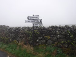
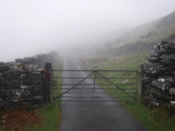
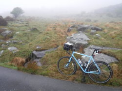
Just in time, I came across a three way signpost that confirmed I was on the right track. That was followed immediately by a closed gate across the road, signposted "Cym Nantcol". I had come across a couple of these gated roads the other day, and didn't let it put me off. I was mentally making a note of every feature I encountered, but when I found myself at yet another closed gate some minutes later, I really couldn't remember whether it was the fifth or the sixth one I had gone through. By this point I was wondering whether I was trespassing deeper and deeper into some angry, shotgun-toting farmer's land, or whether this really was a public road ... and the right public road.

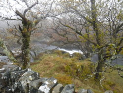
104.JPG 103 Back on track.JPG 105.JPG 106.JPG

107.JPG 108.JPG
After following a trail along the side of a steep drop, I eventually came across another recognisable junction, and followed the lane on over a few cattle grids until I came across my first house for several miles and then crossed the River Nantcol, reaching a rather nondescript end of the road, where a farmer had parked a large trailer outside a farm entrance. No view to be had at all, except for a few soggy sheep in the mist, but at least I knew exactly where I was on the map. Birdsong and lambs bleating everywhere. Wonderfully peaceful up there.

Dropped down through the fog and across into the Bychan valley, where I again heard the cuckoo that I had heard the other day. Down past some waterfalls and a lake, and lots more soggy sheep until I arrived back on the main road in Llanbedr. That left just the long drag up the coast road to Llanfair and the drop down to Llandanwg to go. Arrived back for breakfast having done my shortest ride of the week ... 15.4 miles, bringing my total in Snowdonia to 84 miles in 4 rides (the pink bits on this map).

110 A week's rides in Snowdonia.JPG

What a great week's cycling. I reckon I've ridden just about every road I could have ridden in the time available, and it has been really enjoyable. Some of the main roads around here are really a bit dodgy, with dry stone walls right up to the carriageway on both sides of the road and nowhere to swerve to get out of the way. I was hoping to ride the Llanberis Pass, but that was a prime example of that, and I lost all enthusiasm for it. In the end, I loved doing the little hilly roads around Harlech, and the Mawddach Trail was another highlight. All highly recommended. I shall definitely miss this place.
Cheers, Donger.
 

Mrs M

Guru
Location
Aberdeenshire
Not today there weren't! Foggy as hell today, and this shot was typical ...
View attachment 407430
Made for a bit of an adventure, actually. I got off the main road earlier than originally planned, just to feel safe in the mist. That meant taking a little road from Llanbedr that cut across from the Bychan valley to the Nantcol valley, and boy was it a shock. Quite a punchy little climb straight away that forced me to dismount briefly within the first half mile of climbing. Then, when back on the bike, the higher I climbed the thicker the fog got.

I soon realised the folly of relying upon a map based on a copied page from an AA route atlas, when it became clear that some of the road junctions made no sense whatsoever .... as the side roads I was encountering did not apparently exist! This made navigating rather interesting.
In the thick fog, you could sometimes imagine there would be a view of the sea just to one side, but visibility was down to about 50 yards in places, so I couldn't rely on that. Add into the equation the complete absence of signposts at the unexpected junctions, and it was turning into a guessing game. I decided to trust my instincts and just continue straight on until I wasn't climbing any more, and trust that I would recognise the junctions that were shown on my map when I came across them.

Just in time, I came across a three way signpost that confirmed I was on the right track. That was followed immediately by a closed gate across the road, signposted "Cym Nantcol". I had come across a couple of these gated roads the other day, and didn't let it put me off. I was mentally making a note of every feature I encountered, but when I found myself at yet another closed gate some minutes later, I really couldn't remember whether it was the fifth or the sixth one I had gone through. By this point I was wondering whether I was trespassing deeper and deeper into some angry, shotgun-toting farmer's land, or whether this really was a public road ... and the right public road.

View attachment 407432 View attachment 407433 View attachment 407434 View attachment 407435

View attachment 407436 View attachment 407437
After following a trail along the side of a steep drop, I eventually came across another recognisable junction, and followed the lane on over a few cattle grids until I came across my first house for several miles and then crossed the River Nantcol, reaching a rather nondescript end of the road, where a farmer had parked a large trailer outside a farm entrance. No view to be had at all, except for a few soggy sheep in the mist, but at least I knew exactly where I was on the map. Birdsong and lambs bleating everywhere. Wonderfully peaceful up there.

Dropped down through the fog and across into the Bychan valley, where I again heard the cuckoo that I had heard the other day. Down past some waterfalls and a lake, and lots more soggy sheep until I arrived back on the main road in Llanbedr. That left just the long drag up the coast road to Llanfair and the drop down to Llandanwg to go. Arrived back for breakfast having done my shortest ride of the week ... 15.4 miles, bringing my total in Snowdonia to 84 miles in 4 rides (the pink bits on this map).

View attachment 407438
What a great week's cycling. I reckon I've ridden just about every road I could have ridden in the time available, and it has been really enjoyable. Some of the main roads around here are really a bit dodgy, with dry stone walls right up to the carriageway on both sides of the road and nowhere to swerve to get out of the way. I was hoping to ride the Llanberis Pass, but that was a prime example of that, and I lost all enthusiasm for it. In the end, I loved doing the little hilly roads around Harlech, and the Mawddach Trail was another highlight. All highly recommended. I shall definitely miss this place.
Cheers, Donger.
Lovely write up on your wee trip and great pics too :okay:
Thank you :smile:
 

Rickshaw Phil

Overconfidentii Vulgaris
Moderator
Time for the May challenge ride:

I decided to repeat the recent ride to Llyn Efyrnwy, but to use the Galaxy this time for its first big ride of the year and the biggest ride I've done on it since fitting the B17N saddle.

Setting out the conditions were cool and cloudy. I went for the long version of the outbound route and added a little extra mileage by going through Condover. At Hunger Hill another cyclist asked whether I had a map. He was headed for Ludlow, trying a new route off Strava, but his Garmin had thrown a wobbly and didn't know where it was. I showed him where we were and after a bit of a chat he carried on in the hope that it would reset itself when he got back onto the planned route.

More mileage was added by going through Pontesbury and Minsterley, the latter of which was filled with a strong smell of cooking beef as the corned beef factory prepares another batch. This was also where a problem presented itself as I ran into drizzly weather which I hadn't expected from the forecast. I just caught the edge of it here but further on at Prince's Oak I could see that it looked very wet in the direction I was headed. I was determined to get the imperial century in today regardless, so carried on with the intention of changing the route if it looked like the rain over the Tanat Valley was going to persist.

I paused for my second breakfast in a gateway between Melverley and Maesbrook and fortunately the rain clouds disappeared to the northeast before I hit the road again so it was back to the original plan.

The wind has been light all day which made for easy progress up the Tanat Valley. Traffic was lighter than last time I was here and it was all very enjoyable. Soon I was turning off to pass through Hirnant (the road here is still as bad). A concrete mixer was delivering part way up the valley, which blocked a delivery van but I was able to get past while they sorted themselves out.

Having got over the summit the descent the other side was fairly fast but I had to take care of the bad surface and a motorist coming the other way stopped to let me by having seen that I needed extra room. Much appreciated - Thankyou.:okay:

One of the worst bits of road at Abertridwr has been resurfaced since I was last here. Very nice and I hope that the rest of the Hirnant Valley will be looked at in due course.

Finally I arrived at the dam. Another bite to eat here and I carried on round the lake. The wind had picked up a bit and I was riding against it to start with. This made me try the drops again having had some success with them riding against the wind a few days ago, and I ended up riding most of the way round the lake like this. Having had a long lasting dislike of drop handlebars it has taken a while to use them properly but I liked.

I dropped in at the Old Barn Cafe and partook of a hot chocolate and a couple of slices of bara brith, which was nice, before retracing my steps round the lake again, and once more doing most of it at a reasonable pace on the drop bars.

I took the alternative route back over the hills (a much quieter lane and fewer potholes) then once back at Pen-Y-Bont Fawr I headed back down the Tanat Valley. I had the wind behind me for the return trip and with my new-found liking of the drop bars, spent a lot of time on them as I enjoyed a fast return trip.

I had a pause at Llynclys on the way back and here found that riding on the drops uses muscles that aren't normally worked that hard. In other words I was starting to ache. Despite this I thought it might be best to take the longer but quieter route home as there was heavier traffic about now due to being the Friday before a bank holiday weekend, I therefore headed for Melverley again.

Llynclys to Melverley was taken fairly steadily (but not particularly slowly), then a couple of other cyclists overtook me and left me standing. Often I'd be temped to go after them, but not today. Instead I carried on at my steady pace to Westbury, where picked up a gentle tailwind and got a great run to Nox.

Somewhere around Lea Cross I started to run out of energy so the pace slowed and by the time I climbed Lyth Hill it was an effort to keep moving. Just as well it wasn't far to home now.

116.44 miles this trip at 14.3 mph average which I'm quite pleased with. 32.7 maximum.

It wasn't planned but the odometer just clicked over onto 1,000 miles since I've owned this bike as well.^_^

The stairs are a struggle now and I'm going to properly ache in the morning. I'm supposed to be helping to assemble a shed - oops.:blush:

DSC0006251.jpg

Quite early on and there is lots of low cloud and mist round the Stretton hills.

DSC0006252.jpg

That wasn't in the script. Drizzle rolling in as I approach Minsterley.

DSC0006254.jpg

Headed up the Tanat Valley.

DSC0006255.jpg

Gets more seriously hilly as I approach Pen-Y-Bont Fawr.

DSC0006260.jpg

I've arrived at the dam. A bite to eat here before a quick lap of the lake.

DSC0006261.jpg

A view acoss the lake from the dam.

DSC0006265.jpg

Disturbing the locals.

DSC0006267.jpg

Taking the alternative route back.
 

NorthernDave

Never used Über Member
Just an hour this morning, so I decided to do (some of) Stage 2 of the TdY before the pros had a go at it. ^_^

Local roads to start, the up Leeds Road to Scholes and onto the route along Main Street, into a surprisingly stiff breeze and through the village. Very nice not to have to negotiate any parked cars on the narrow streets today.
Life in my hands then for a dash along the A64 to Thorner Lane, but it was oddly quiet for the time of day. Onto Thorner Lane and the descent into Thorner itself down Sandhills (the Van Zyl graffiti from the other year is all but gone now...).
Close pass of the day from a muppet in a pick up who simply had to get in front, then faced with a car coming the other way thought it better to squeeze me to the kerb than brake, then had to brake again as he'd caught up with the car in front that was doing the speed limit...:cursing:
Onto Thorner Main Street and stopped for a quick photo:
IMG_20180504_082724451_HDR.jpg

Back on the bike and through the village, taking the turning onto Milner Lane (unlike the lead car, the police escort motorcycle and the breakaway during the mens race...:whistle: ) and back out into the countryside.
Up onto the ridge and along to East Rigton, where I left the route and did a long loop back around via Bramham Lane, Jewitt Lane and Holme Farm Lane, before retracing my earlier route back along Milner Lane into Thorner.
Past yet more council workers on road sweeping duties and onto Main Street, before turning right onto Carr Lane to head up to the A58, the Coal Road and local roads down to home.

15.51 miles (24.96 km :rolleyes: ) in 1h 8m at an average of 13.6mph and with 784ft climbed.

Happy with that and the chance to get a ride in with everything else I've had on today. Warm enough for shorts and a short sleeved top too :okay:

And to end, the map:
04052018.JPG
 

gavgav

Legendary Member
Not today there weren't! Foggy as hell today, and this shot was typical ...
View attachment 407430
Made for a bit of an adventure, actually. I got off the main road earlier than originally planned, just to feel safe in the mist. That meant taking a little road from Llanbedr that cut across from the Bychan valley to the Nantcol valley, and boy was it a shock. Quite a punchy little climb straight away that forced me to dismount briefly within the first half mile of climbing. Then, when back on the bike, the higher I climbed the thicker the fog got.

I soon realised the folly of relying upon a map based on a copied page from an AA route atlas, when it became clear that some of the road junctions made no sense whatsoever .... as the side roads I was encountering did not apparently exist! This made navigating rather interesting.
In the thick fog, you could sometimes imagine there would be a view of the sea just to one side, but visibility was down to about 50 yards in places, so I couldn't rely on that. Add into the equation the complete absence of signposts at the unexpected junctions, and it was turning into a guessing game. I decided to trust my instincts and just continue straight on until I wasn't climbing any more, and trust that I would recognise the junctions that were shown on my map when I came across them.

Just in time, I came across a three way signpost that confirmed I was on the right track. That was followed immediately by a closed gate across the road, signposted "Cym Nantcol". I had come across a couple of these gated roads the other day, and didn't let it put me off. I was mentally making a note of every feature I encountered, but when I found myself at yet another closed gate some minutes later, I really couldn't remember whether it was the fifth or the sixth one I had gone through. By this point I was wondering whether I was trespassing deeper and deeper into some angry, shotgun-toting farmer's land, or whether this really was a public road ... and the right public road.

View attachment 407432 View attachment 407433 View attachment 407434 View attachment 407435

View attachment 407436 View attachment 407437
After following a trail along the side of a steep drop, I eventually came across another recognisable junction, and followed the lane on over a few cattle grids until I came across my first house for several miles and then crossed the River Nantcol, reaching a rather nondescript end of the road, where a farmer had parked a large trailer outside a farm entrance. No view to be had at all, except for a few soggy sheep in the mist, but at least I knew exactly where I was on the map. Birdsong and lambs bleating everywhere. Wonderfully peaceful up there.

Dropped down through the fog and across into the Bychan valley, where I again heard the cuckoo that I had heard the other day. Down past some waterfalls and a lake, and lots more soggy sheep until I arrived back on the main road in Llanbedr. That left just the long drag up the coast road to Llanfair and the drop down to Llandanwg to go. Arrived back for breakfast having done my shortest ride of the week ... 15.4 miles, bringing my total in Snowdonia to 84 miles in 4 rides (the pink bits on this map).

View attachment 407438
What a great week's cycling. I reckon I've ridden just about every road I could have ridden in the time available, and it has been really enjoyable. Some of the main roads around here are really a bit dodgy, with dry stone walls right up to the carriageway on both sides of the road and nowhere to swerve to get out of the way. I was hoping to ride the Llanberis Pass, but that was a prime example of that, and I lost all enthusiasm for it. In the end, I loved doing the little hilly roads around Harlech, and the Mawddach Trail was another highlight. All highly recommended. I shall definitely miss this place.
Cheers, Donger.

Crikey that is a pea souper, I’ve not seen it quite that bad before!! The gated roads are certainly plentiful around there. The first time i explored around there, I had the same concerns as you, as to whether I was trespassing onto private land, but no one has stopped me......yet!!

Safe journey home.
 

Old jon

Guru
Location
Leeds
Today. Well, today was intended to be a gentle easy day, a ride this morning followed by a gentle bit of baking this afternoon. The ride was fine, baking started gentle and then some kind soul delivered a washing machine. OK, we had ordered the thing but delivery was supposed to be next week. Anyway, the ride.

After a squint at the map, the shore road ( AKA Beira mar ) looked good yet again, but with intentions of riding further this time. Ambitions of a fifteen mile ride were there, I actually managed 14.6 and I am going to blame the padding on top of the saddle for this. Most uncomfortable, squirming away underneath like it does. My rump may become accustomed to this but a Brooks will be bought and fitted, shame is I am not due back until August . . .

As ever with a new anything, there are still niggling little bits to adjust, so Beira Mar being a ride along a cycle track is pretty good for unscheduled stops to tighten this or curse that. Through the week it is a fairly quiet bit of riding, look out for the distracted pedestrian and all will be well. Under Hercilio Luz yet again, the bridge that bears his name, to be accurate. After this the riding becomes more unpredictable, the road is pretty good for a while but then degenerates into a freeform cloverleaf type of thing, where you need to choose your lane two hundred yards before you reach it. OK there is a shared use track available, looks like it has been shared with pile drivers and centurion tanks. Which makes for a good road surface around here. This leads to the Plaza Hotel, the furthest south I have reached before today, but today I rode on another couple of miles or so. The road rises, gently, and travelling along it reveals another bay, this one without most of the high rise development that the other bay has. Looks like wider beaches also. I decided to turn around, and enjoyed the descent of a not so steep hill.


The ride back, well, the reverse of the ride out with a bit of breeze to cool me down a bit. More cyclists around and a solitary net fisherman on the bridge over the Rio Itacorubi. A few extra yards up the hill to the apartment brought a grin, and a bigger grin when I washed off the sweat and drank a coffee. Good to find out more, cannot wait for the next trip out.

A longer doodle

04052018.jpg
 
Time for the May challenge ride:

I decided to repeat the recent ride to Llyn Efyrnwy, but to use the Galaxy this time for its first big ride of the year and the biggest ride I've done on it since fitting the B17N saddle.

Setting out the conditions were cool and cloudy. I went for the long version of the outbound route and added a little extra mileage by going through Condover. At Hunger Hill another cyclist asked whether I had a map. He was headed for Ludlow, trying a new route off Strava, but his Garmin had thrown a wobbly and didn't know where it was. I showed him where we were and after a bit of a chat he carried on in the hope that it would reset itself when he got back onto the planned route.

More mileage was added by going through Pontesbury and Minsterley, the latter of which was filled with a strong smell of cooking beef as the corned beef factory prepares another batch. This was also where a problem presented itself as I ran into drizzly weather which I hadn't expected from the forecast. I just caught the edge of it here but further on at Prince's Oak I could see that it looked very wet in the direction I was headed. I was determined to get the imperial century in today regardless, so carried on with the intention of changing the route if it looked like the rain over the Tanat Valley was going to persist.

I paused for my second breakfast in a gateway between Melverley and Maesbrook and fortunately the rain clouds disappeared to the northeast before I hit the road again so it was back to the original plan.

The wind has been light all day which made for easy progress up the Tanat Valley. Traffic was lighter than last time I was here and it was all very enjoyable. Soon I was turning off to pass through Hirnant (the road here is still as bad). A concrete mixer was delivering part way up the valley, which blocked a delivery van but I was able to get past while they sorted themselves out.

Having got over the summit the descent the other side was fairly fast but I had to take care of the bad surface and a motorist coming the other way stopped to let me by having seen that I needed extra room. Much appreciated - Thankyou.:okay:

One of the worst bits of road at Abertridwr has been resurfaced since I was last here. Very nice and I hope that the rest of the Hirnant Valley will be looked at in due course.

Finally I arrived at the dam. Another bite to eat here and I carried on round the lake. The wind had picked up a bit and I was riding against it to start with. This made me try the drops again having had some success with them riding against the wind a few days ago, and I ended up riding most of the way round the lake like this. Having had a long lasting dislike of drop handlebars it has taken a while to use them properly but I liked.

I dropped in at the Old Barn Cafe and partook of a hot chocolate and a couple of slices of bara brith, which was nice, before retracing my steps round the lake again, and once more doing most of it at a reasonable pace on the drop bars.

I took the alternative route back over the hills (a much quieter lane and fewer potholes) then once back at Pen-Y-Bont Fawr I headed back down the Tanat Valley. I had the wind behind me for the return trip and with my new-found liking of the drop bars, spent a lot of time on them as I enjoyed a fast return trip.

I had a pause at Llynclys on the way back and here found that riding on the drops uses muscles that aren't normally worked that hard. In other words I was starting to ache. Despite this I thought it might be best to take the longer but quieter route home as there was heavier traffic about now due to being the Friday before a bank holiday weekend, I therefore headed for Melverley again.

Llynclys to Melverley was taken fairly steadily (but not particularly slowly), then a couple of other cyclists overtook me and left me standing. Often I'd be temped to go after them, but not today. Instead I carried on at my steady pace to Westbury, where picked up a gentle tailwind and got a great run to Nox.

Somewhere around Lea Cross I started to run out of energy so the pace slowed and by the time I climbed Lyth Hill it was an effort to keep moving. Just as well it wasn't far to home now.

116.44 miles this trip at 14.3 mph average which I'm quite pleased with. 32.7 maximum.

It wasn't planned but the odometer just clicked over onto 1,000 miles since I've owned this bike as well.^_^

The stairs are a struggle now and I'm going to properly ache in the morning. I'm supposed to be helping to assemble a shed - oops.:blush:

View attachment 407445
Quite early on and there is lots of low cloud and mist round the Stretton hills.

View attachment 407446
That wasn't in the script. Drizzle rolling in as I approach Minsterley.

View attachment 407447
Headed up the Tanat Valley.

View attachment 407448
Gets more seriously hilly as I approach Pen-Y-Bont Fawr.

View attachment 407449
I've arrived at the dam. A bite to eat here before a quick lap of the lake.

View attachment 407450
A view acoss the lake from the dam.

View attachment 407451
Disturbing the locals.

View attachment 407452
Taking the alternative route back.
Thats the best colour of Galaxy to Have in my opinion.
 

biggs682

Itching to get back on my bike's
Location
Northamptonshire
6.7 miles into this morning's ride

IMG_20180505_054304566.jpg


And this happens

IMG_20180505_055315791.jpg


2 miles into return

IMG_20180505_061410890.jpg


When I got home .
 

Mr Celine

Discordian
For Friday's after w*rk ride I thought I'd try the hill from Thornylee to Laidlawstiel. I've never been up it before and only once gone down, many years ago on a Raleigh Pioneer with very poor canti brakes. To get there requires a couple of miles on the A72, a road I normally avoid due to the traffic (compared to other borders roads that is). I got there without incident, the climb has fantastic views down the Tweed valley from half way up, but no photos as I wasn't in the mood for stopping. Mission accomplished I carried on over the Windydoors climb towards Stow. From there is a choice of hills, either Lauder common which is long and starts at 15% or the shorter and steeper hillclimb route, which is the one I went for. At the top I took a short detour into the windfarm for a breather.

One for the 'your bike dwarfed by a wind turbine' thread -

IMG_20180504_174427_7[1].jpg


Slightly closer, looking north with another wind turbine and the Gilston wind farm in the distance -

IMG_20180504_174504[1].jpg


Looking west, towards Windydoors on the other side of Wedale (the valley of the Gala Water).

IMG_20180504_174532[1].jpg


Now, suitably rested and recharged, I set off at 101.1 mph. At least that's what strava says.
Standing under a spinning turbine must have confused the GPS.

upload_2018-5-5_9-31-48.png


30.6 miles, 2828 feet ascent, average 14.2mph, max 101.1mph. ;)
 
Ok so having seemingly got better from an evil chest infection/ pleurisy type symptoms and having been bored out of my brains all week not being able to do anything (including breathing properly) except subject myself to the “entertainment” that is daytime television, I decided in my infinite wisdom to venture out on this very sunny morning for a steady roll along the local lanes. For those who don’t know or follow the thread, I am part of the CycleChat metric/ imperial half century a month challenge and so the drive to get one in for this month was overwhelming me, especially having suffering from a bad dose of cabin fever!
The route was planned, nothing too major, all I had to do was get going.
It started off really well- nice and steady- but as I got to “Top Brand” at Griffydam which, as the Leicestershire/ South Derbyshire lot will know, is a two-mile ish flat section and which the local bike club Coalville Wheelers use for time trials, I was feeling good and so gave it some, getting all “aero” and using the drops for the first time ever!
I did quite good I thought, averaging about 23ish for that section and so my confidence grew a bit. But then the fatigue from lumping a 14 1/2 stone body in a less than 100% fit state began to kick in and I had to pull over and have a breather and a drink. It was here when I looked down at my garmin and saw I’d done 9.5 miles in 29 mins that I realised I was going WAAAY too hard for my comfort zone and unsurprisingly why I was knackered! The next few miles took me across to Whitwick which is fairly hilly in all directions but I believed that I had chosen one of the easier climbs around there in my route planning.
That “easier climb” might as well have been alpe d’huez as the fatigue and laboured breathing were getting too much to take and so I pulled over again (at the top) to get myself right. After a few minutes rest, a drink and a gel I set off again through some more quiet lanes, taking advantage of the flats and downhill sections. There were two more climbs to pick up- one long and slow the other short and steep- but I managed these with relative ease and on reflection I put it down to the gel that I had consumed 10-15 mins previous and a second wind.

Then it was about 5 1/2 miles of rolling roads through the beautiful rural Leicestershire countryside and back home.

I’m glad I got the required miles in for the challenge but on reflection I should not have gone too hard.

Anyhoo, 32 sunny smiley ones for me today and a well earned chill in the back garden now awaits. :becool:


Check out Couldn’t help myself.... on Relive! https://www.relive.cc/view/1550690851

https://www.strava.com/activities/1550690851
 
Top Bottom