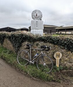
Did some cycling around the Surrey/Sussex/Hampshire borders today, primarily trying to bag some map files on Veloviewer, as I had a big gap down there. Was on a time limit so drove down to Dunsfold to save 2 hours.
Stuck the Garmin on the handlebars, switched on, and ... WHERE'S MY ROUTE?
Oh well, I'll start recording and just use Garmin maps and navigation. WHERE'S MY UK MAP?!!!
Couldn't even route using Google Maps because it was offline (poor phone reception), but it did have offline map data. Better still was the Organic Maps apps which has offline Rights of Way data, but I prefer planning routes on a big monitor so I can see all the choice of local roads; navigating on the fly meant I made some poor choices.
But considering I was in southeast England, just 30 miles from central London, some of the farmland I cycled past felt incredibly remote. Never more than a 2 or 3 miles from a hamlet, but glimpses of Sussex from days gone by. My kind of cycling.
Anyway, explored south of Dunsfold as far as Wisborough Green, then West to Balls Cross and Northchapel. Went north on the A283 but soon turned west and took back lanes up to Chiddingfold, and by then was running out of time so headed fairly directly back to Dunsfold.
The numbers: 72.46km / 45 miles, with 748 m of ascents, and a slow moving speed of 19.6 km/h (just over 12 mph).
The veloviewer stats: 33 new squares, which increased my cluster by 41, thanks to filling in some gaps. Max square unexpectently went up from 18x18 to 19x19, but I've put down the foundations for a significant increase in 2025.
Found a VERY derelict section of the Wey & Arun canal.
The flood at Shillinglee
To the Manor born...
An unusual "no through road" sign:
<insert own joke here>
Funky treestump:
And my wiggly route


