Bike selected; CGR (due to the weather, & I had a guess, I might head into the Woods)
Weather; overcast. quite cold, intermittent rain/hail, west wind
Photographs from today (unless captioned otherwise)
A late start (10:30 turned), & just a pootle
Up towards the rather nice conversion of the old PineApple Inn, to a house, with a left turn onto Crossley Street, which offers a very wide expansive view (as far as Midhopestones Moor; above LadyBower Reservoir, HolmeMoss & Saddleworth Moor)
http://www.geograph.org.uk/photo/286546
At the end of Crossley Street, a right turn onto Weeland Road, with an almost immediate left, onto (old) Pontefract Road, by Spring Green Nurseries
Over the Wakefield - Doncaster road, by the Cock & Crown, to arrive in Crofton at the site of the old West Yorkshire Police Driver Training Centre
For many years, the Force maintained offices here, & a skid-pan
Now houses...................................
Up Church Hill into Crofton itself, to pass a pub linked to a very famous industrialist (whose eponymously named village is now a UNESCO World Heritage site
Now renamed
http://www.geograph.org.uk/photo/125527
http://www.geograph.org.uk/photo/2935427
Past another pub (now converted to flats) 'The Slipper'
http://www.geograph.org.uk/photo/5299013
Out into a bit of what passes for open countryside, but reclaimed mining land
Through Wintersett, with the duck-pond opposite the
Anglers Retreat overflowing to cover the road, from kerb to kerb
http://www.geograph.org.uk/photo/3407959
A right turn onto Haw Park Lane, towards
Anglers Country Park, a reclaimed open cast (250 feet deep!!!)
http://www.wakefield.gov.uk/sport-and-leisure/parks-and-countryside/parks/anglers-country-park
Looking from Haw Park Lane, towards Wintersett Reservoir, now used for dinghy sailing & fishing
It, & the abutting Cold Hiendley Reservoir were built to supply water to the Barnsley Canal
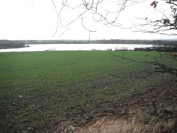
A quick check of the café, to see if there was anyone I knew there, be it cyclist, or runner
No-one
Head off down towards Haw Park Woods, via a rather wet. mucky, muddy, water-logged lane
With the dilapidated boundary wall to Waterton Park, to my right
The Squire of the time, Charles Waterton, had it built to keep poachers off his land, and protect the wildlife within, often spending hours watching
It's being put forward for a UNESCO World Heritage listing, as the worlds first Nature Reserve
https://www.yorkshirepost.co.uk/new...-estate-designated-at-heritage-site-1-7216101
http://www.bbc.co.uk/bradford/sense_of_place/walton_1.shtml
https://www.experiencewakefield.co.uk/thedms.aspx?dms=3&feature=1073&venue=2190474
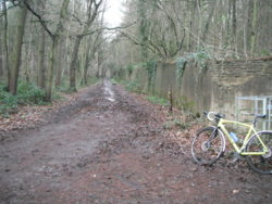
It soon heads downhill, with large muddy patches
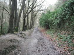
Looking back up, with the wall still there (getting on for 3 miles, when built)
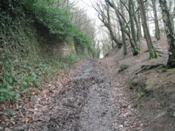
A fair bit drier here, & right at the bottom of the track
http://www.geograph.org.uk/photo/2811830
Out we pop, onto the towpath of the (abandoned) Barnsley Canal, with a short hail-storm here (or maybe just icy sleet?)
Onto the driveway of Waterton Hall, as it is now (a lovely 'gentlemans residence' on its own island)
It was once used as a maternity hospital, which must have made for some very fraught dashes over the cast-iron bridge!!!
http://www.watertonparkhotel.co.uk/
A slight detour, put me back on the route of the Barnsley Canal, where a bridge is now infilled underneath, & the Canal route built upon
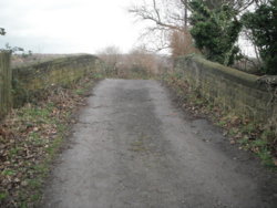
See the bottom two pictures, this is the bridge, I photographed
http://www.penninewaterways.co.uk/barnsley/ba33.htm
Back up Oakenshaw Lane, to recross the Canal again, on a lowered bridge
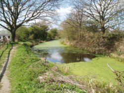
Just to the west of the bridge, this section is still in water
(a fishing club owns it)
Saturday 18th April 2015
Back onto Doncaster Road, & a navigation of the new junction, & home via Black Road, with a nice tail-wind up-hill

Past the PineApple. & back home
Short, sweet, historic & muddy!!!


 )
)
 so more forecasting lies...) and the remnants of yesterdays snow was still on the side roads, so I decided to stick to roads likely to have been gritted. This led to Coal Road, then Skeltons Lane and the descent of Sandhills into Thorner, where I stayed on the main route and up Church Hill. Despite sticking to busier routes the bike had been a bit twitchy on slippery surfaces in a few places so I was taking it steady and keeping well away from the road edge.


 Now feeling normal after an afternoon nap. Looking forward to a Sunday ride, the wind looks to be going away.