@Norry1 ,Looks like there are roads in off the B4086 , industrial estate possible looks easy unless there private gated roads
You are using an out of date browser. It may not display this or other websites correctly.
You should upgrade or use an alternative browser.
You should upgrade or use an alternative browser.
Page may contain affiliate links. Please see terms for details.
UphillSlowly
Making my way slowly uphill
I think there is a military area which makes it difficult. Have cycled there near edgehill. On my planner I would go on the small lane connecting Radway to the A422, then push bike up footpath that takes you to edge of the military complex (or use MTB)
UphillSlowly
Making my way slowly uphill
DSDA = Defence Storage and Distribution Agency
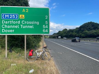
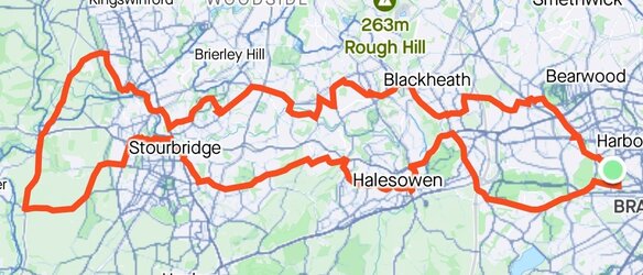
Sorry for the rather quiet post last night. A journey up to London, naturally with tiling aspirations.


My plan is probably pretty clear at this point!
Then an attempt was made to balance East London (just a radial for future tiling use), but I really fancied trying out the Dartford shuttle anyway.


My plan is probably pretty clear at this point!
Then an attempt was made to balance East London (just a radial for future tiling use), but I really fancied trying out the Dartford shuttle anyway.
Attachments
The permissive path stops just short of the tile but from the Strava heatmap it looks like people have snook over the border from it:
View attachment 695997
I was planning on going up the bridleway from Westcote Farm. The images that I found on Geograph looked OK when it was dry:
View attachment 695999
I may have a go at the NW corner route today. I passed through Little Kineton yesterday and was tempted to divert onto this route - but I was in the middle of a 3 x 15 min Threshold effort workout so I gave it a swerve

I may have a go at the NW corner route today. I passed through Little Kineton yesterday and was tempted to divert onto this route - but I was in the middle of a 3 x 15 min Threshold effort workout so I gave it a swerve
Got it today
And you didn't get shot result
HLaB
Marie Attoinette Fan
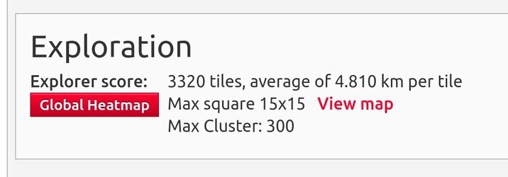
My Gravel bike is still in the shop (I got back too late to collect it) but I noticed a road route avoiding the A16 to a tile up near Crowland which was stopping my Max Square increasing (I just need to grab the corresponding tile at the other end of my 20x20 grid with the gravel bike to actually expand it. I also noted an easy tile to grab without being on the A47 for long (I actually stayed on it longer than I planned). So I'm now at:


UphillSlowly
Making my way slowly uphill
HLaB
Marie Attoinette Fan
Extended my commute again and got myself another 10 tiles.


Looks like I left a hole at Newgate Street! To get that I'd have to go on the gravel bike and I'm not sure if 30miles round is too much for after work at a slower speed 🤔

Looks like I left a hole at Newgate Street! To get that I'd have to go on the gravel bike and I'm not sure if 30miles round is too much for after work at a slower speed 🤔


