The CC Trig Point bagger thread, now incorporating other interesting geographs

Page may contain affiliate links. Please see terms for details.

classic33

Leg End Member
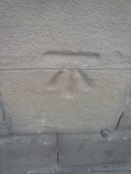
The thing I've noticed, that in the same area, you get varying types of the mark as if done by different hands.
The bloke I spoke with yesterday had thought as the building was just above sea level thought it was a flood mark, boy, he said he was glad it wasn't. I told him, I'd swap my near top of the hill house for his, sadly not taken up.
There was/is in some areas, the same symbol used the other way round(Arrow pointing down) for use as a flood mark. Usually higher up on the building and around man-made/influenced water features.

One seen on a regular basis was 75 yards back from the waters edge. The water reached that and compensation would have to be paid. This would have meant the deep end would be knee deep, but with three quarters of the field lost.
 

classic33

Leg End Member
Hi-Q, Horton Street. Someone claims to have vistited it in March this year, when the wall was painted blue. It's been black, not blue, for a while now.
CAM00290.jpg

Westgate, Union Street/Westgate, vandals!
CAM00292.jpg
CAM00291.jpg

Listers Bridge, showing the wall adapted for the Trig Point
CAM00293.jpg

Spot Height Marker, Listers Bridge(A few over the years)
CAM00294.jpg

Bull Green Roundabout. Not on any records
CAM00296.jpg

15 Foot Gate for sale
Both posts. Buyer collects! Any reasonable offer accepted.
CAM00295.jpg
 
Last edited:

classic33

Leg End Member
The thing I've noticed, that in the same area, you get varying types of the mark as if done by different hands.
The bloke I spoke with yesterday had thought as the building was just above sea level thought it was a flood mark, boy, he said he was glad it wasn't. I told him, I'd swap my near top of the hill house for his, sadly not taken up.
Different styles between first and second time the marks were made.
 

PeteXXX

Cake or ice cream? The choice is endless ...
Location
Hamtun
Nice boot scraper, as well.
It is, and probably 100years old :smile:
 

classic33

Leg End Member
Saint Mary's, Clarence Street
CAM00299.jpg

Saint Mary's, Gibbet Street
CAM00300.jpg

79 Gibbet Street, Bedford Street South, with Pin.
CAM00301.jpg

Griffin Hotel, George Street, West Side/Bull Green, with Pin.
CAM00298.jpg

Saint James' Church, corner where mark has been recorded as visited this year. Parking overflow/waiting area for bus station 40+ years ago.
CAM00302.jpg

Parish Church, boundary wall. Church Street/Berry Lane junction
CAM00306.jpg

Parish Church, adjoining stones, North Side
CAM00303.jpg

CAM00304.jpg

Thinking caps for this one. One of three, on what was the inner wall now the outer. Above ground level on the inside.
CAM00305.jpg
 

Attachments

  • CAM00298.jpg
    CAM00298.jpg
    40.7 KB · Views: 40
Top Bottom