The CC Trig Point bagger thread, now incorporating other interesting geographs

Page may contain affiliate links. Please see terms for details.
There'll possibly be a trip to Lincoln on Sunday, so lots to see/photograph:okay:
 
OP
OP
Drago

Drago

Legendary Member
South Northamptonshire, Ashton railway bridge. I don't think this one is in the database.

543874

543876
 

winjim

Smash the cistern
Trig point at the base of the Crich memorial tower, memorial to members of the Sherwood Foresters / Mercian / Worcestershire & Sherwood Foresters regiments.

543877


543883


View from the top, looking towards Crich

543880


Looking the other way's a bit weird as you can see how much it's been quarried.

543879


Me and him at the base.
543881


543882
 

Attachments

  • 20200827_123043.jpg
    20200827_123043.jpg
    195.4 KB · Views: 2
Today
1.


Metal sign
Barnsdale Road (A656)
Castleford (1)

A mixture of road-salts/age & immersion in flood waters

544191


The photographer practically had his back to the sign
https://www.geograph.org.uk/photo/667501


1. Barnsdale Road is the continuation of the Roman Road, that left the 'Great North Road' (A1) at Barnsdale Bar, before passing through Pontefract, then being lost under the streets of Castleford
Castleford was Lagentivm, to the Romans
From here, it neads due north, and indeed after 'Peckfield Bar'(where it intersects with the A63 Leeds-Selby road) it changes name to (Roman) Ridge Road
Then.... to the north of Aberford - literally, just south of 'Bramham Cross-Roads (not a cross-roads anymore, but there is the remains of that!, if you know where to look), it swings north-east to Tadcaster (Calcaria, to the Romans)
 
Today
2.


Castleford Lock
Castleford

544192


Note the reused railway lines used to prevent vehicles straying onto the grass, where the land slopes steeply to the 'Cut'
544193


This is where the Rivers Aire & Calder meet, with the Castleford Cut avoiding the Weir on the Aire
The Aire becomes navigable again, then, until Ferrybridge, where there's another 'cut'/canal to avoid Knottingley Weir


The railings on the Lock are the ones seen in my picture; https://www.geograph.org.uk/photo/2784373


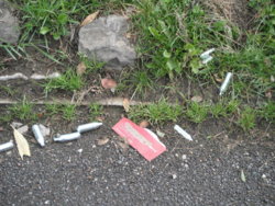
Rather more ominously, either there's been a lot of punctures there, or the local ferals are inhaling gases on the access road
There were a lot more spread around
544195
 
Today
3.


Millenium Bridge/Castleford Weir
Castleford
Spanning the River Aire, & linking Mill Lane (north of river) & Aire Street (south of river)

544197


Allinsons Flour Mill, to the extreme left
Crimea Tavern (closed) with the blue hoarding on the side
544196


https://www.geograph.org.uk/photo/4446444
Looking north; https://www.geograph.org.uk/photo/3270131
https://www.geograph.org.uk/photo/6354093
 
Last edited:
Top Bottom