The CC Trig Point bagger thread, now incorporating other interesting geographs

Page may contain affiliate links. Please see terms for details.

snorri

Legendary Member
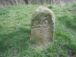
What's the dimensions on the visible part of that block?
Approx 200mm square and 300mm high.
There are two cairns on the site and several of these blocks situated some 30 metres from each cairn structure, I could see no other marking on the blocks other than the two arrows.
(I did not have this thread in mind when I took the pic. a few weeks ago so I'm just relying on memory)
 

Bobby Mhor

Legendary Member
Location
Behind You
nr Kilmacolm, B788
Finally, I've looked many times for this one, pretty faint
NS 3292 6924 nr KIlmacolm, B788, Rock.jpg

Port Glasgow, Broadstone Ave
Found on detour
NS 3117 7446 Port Glasgow, Boglestone, Wall.jpg

Port Glasgow, Broadstone
NS 3106 7451 Port Glasgow, Boglestone, Wall.jpg

Post Boxes?
Plenty:laugh:
I checked everyone in my town and a nearby village today
 

classic33

Leg End Member
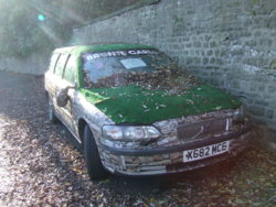
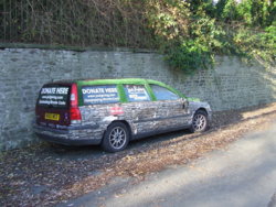
Not a geograph but loved this..
Glasgow to Sahara, charity car.
More info HERE
View attachment 408774

A couple of wall boxes

Bridge of Weir V R
View attachment 408775

Brookfield, a new Lamp style(not cast), pretty soulless I think...Scottish Crown

View attachment 408776
There's a few like that last one round here. Stainless steel plate in place of cast marks. Seems they were expecting a change, but uncertain of who would be there. The plate can just be drilled out and replaced.
 

Tim Hall

Guest
Location
Crawley
This post, I assume?
View attachment 408481
I haven't a clue , tbh....
Seeing as you're all struggling and I'm a nice person, I'll tell you. It's a memorial on the Mull of Oa on Islay to commemorate the sinking of two troopships in WW1 carrying US troops. They had centenary stuff the week before last, including wreath laying, Royal Marines band etc and I was lucky enough to be there. It made the BBC news, where I can be glimpsed for a nanosecond.
 

Bobby Mhor

Legendary Member
Location
Behind You
Seeing as you're all struggling and I'm a nice person, I'll tell you. It's a memorial on the Mull of Oa on Islay to commemorate the sinking of two troopships in WW1 carrying US troops. They had centenary stuff the week before last, including wreath laying, Royal Marines band etc and I was lucky enough to be there. It made the BBC news, where I can be glimpsed for a nanosecond.
I got you now,
prog on BBC One Scotland (30 mins) HERE

prog BBC Alba prog (59 mins) HERE
 
Can these be seen??
I only noticed it, as I went for a walk to photograph the Bridge again
I was in Bingley, for the 'Harriers v Cyclists' race
Area


Detail


There's not a photo of it on GeoGraph, so I've used one of the marvellous PackHorse bridge on Beckfoot Lane
My photographs are south-east of the bridge, before the marked Club House
http://www.geograph.org.uk/photo/4323658
 
An oddity, they've been there quite a few years now!!
I think I first saw them about 10 years ago


Tim Hall

Guest
Location
Crawley
I got you now,
prog on BBC One Scotland (30 mins) HERE

prog BBC Alba prog (59 mins) HERE
Thanks for the programme links. I watched the Alba one when I was over there. The flag that was made came back to Islay for the ceremony. We were in the museum when it came in the back door, accompanied by a flustered American woman from the Smithsonian.
 
If I have featured these in the thread previously, I apologise, but I'm not trawling through 137 pages to double-check


As the name states, it's not in Whitby, which is where anything Goth related is expected to be
(even though Bradford, Keighley, Shipley, & Leeds gave birth to some of the bigger names of the genre)
DSCF0612.JPG


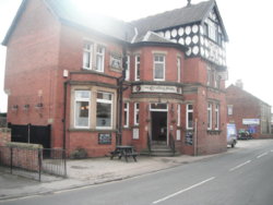
Cricketers Arms
Horbury
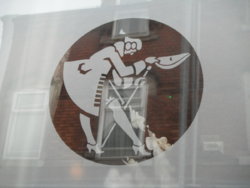
'The Bowing Courtier' The emblem, of Melbourne Breweries of Leeds (a response to Tetleys Huntsman?)
DSCF4452.JPG DSCF4456.JPG


Mile Marker
Aire & Calder Navigation Canal towpath, at 'Stanley Ferry'
(only just north, of the bridge carrying the road between Stanley & Altofts)
it's on the 1908 '25" OS map as a MileStone

Probably to Goole, the ultimate destination of the 'A&C'
Notated in this link;
http://maps.nls.uk/geo/explore/#zoom=18&lat=53.7048&lon=-1.4616&layers=168&b=1

DSCF4567.JPG
 
Top Bottom