Mr Celine
Discordian
- Location
- Waxing my moustache
Somewhere with a jail. Or a rubber band factory.No-one's close yet. It's a lovely place to visit for a week or two, but any longer could be a stretch.
Somewhere with a jail. Or a rubber band factory.No-one's close yet. It's a lovely place to visit for a week or two, but any longer could be a stretch.
View attachment 631696
The answer to your cryptic clue came to me just when I went to bed.
Juggle a german motorbike, ie an anagram of motorrad.
Dartmoor.
https://www.google.co.uk/maps/@50.5...3P6nD17eabXU2TxFfT_g!2e0!7i16384!8i8192?hl=en
View attachment 631696
The answer to your cryptic clue came to me just when I went to bed.
Juggle a german motorbike, ie an anagram of motorrad.
Dartmoor.
https://www.google.co.uk/maps/@50.5...3P6nD17eabXU2TxFfT_g!2e0!7i16384!8i8192?hl=en
Exactly, hence emphasising language a few posts later.The answer to your cryptic clue came to me just when I went to bed.
Juggle a german motorbike, ie an anagram of motorrad.
Dartmoor.

I thought my second para was spot on: Road on a plateau, not the Yorks Wolds. That fits Dartmoor.You'll be wanting information to narrow down the search then. The road formed part of the route of a recent edition of the Tour of Britain. I would of thought my earlier clues were more directly helpful, but we shall see.
Perhaps I should emphasise that @Dogtrousers was getting very warm in post 5086 until veering off in the final paragraph.


Shows I ought to read a little more carefully at times.I thought my second para was spot on: Road on a plateau, not the Yorks Wolds. That fits Dartmoor.

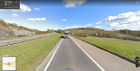
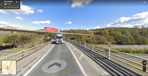
I'm 90% certain that it's around junction 10 on the M90... but the place has changed so much it's hard to find the exact location of Mr Celine's shot.
I reckon it's either about here, or somewhere completely different.
View attachment 631751
https://www.google.com/maps/@56.368...4!1s6lwBZcKccjSuwngff2zYBw!2e0!7i16384!8i8192
the bridge with its wonky stilts is obscured by the trees and that truck... this is a little further back:
View attachment 631750

