Your ride today....

Page may contain affiliate links. Please see terms for details.

skudupnorth

Cycling Skoda lover
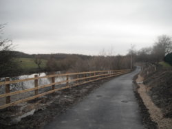
Another nice ride to work this morning in the fine rain that wets you through ! Extended it by exploring another section of route 55 and it was well worth it.
 

Attachments

  • 85B9437D-1C5F-4817-BD1B-2336EEF83954.jpeg
    85B9437D-1C5F-4817-BD1B-2336EEF83954.jpeg
    281.3 KB · Views: 22
  • A057C2C5-7EBC-4EF4-9C39-9BC108691ED2.jpeg
    A057C2C5-7EBC-4EF4-9C39-9BC108691ED2.jpeg
    243.1 KB · Views: 25
  • 55042710-A90A-48A3-811B-2F6B7C1ED0C8.jpeg
    55042710-A90A-48A3-811B-2F6B7C1ED0C8.jpeg
    139.5 KB · Views: 29
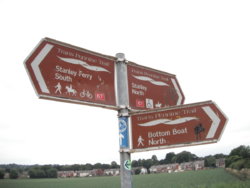
A steady potter around sections of the 'Wakefield Wheel', the 'Altofts - Castleford Cycleway' & the 'Trans-Pennine Trail' this afternoon
They overlap/use same sections at points, & also with the 'Leeds Country Way' (long distance footpath around the Leeds boundaries)
I will write it up tomorrow, as I'm logging-off now, working tomorrow, so up about 05:00

Bike selected; CGR, as there would be some bridleways, cycle-ways & possibly dusty/rough climbs
Weather; rather warm, overcast, & a slight headwind
Photographs from today; unless dated otherwise
Geograph used, to illustrate points


Out from home, over the railway bridge on Station Road, with a right fork onto the 'Wakefield Wheel'/bridleway towards Altofts Hall Road
http://www.geograph.org.uk/photo/1405344

Once off the end of 'A H R', it was a right turn onto Church Road, to pass down through Lower Altofts, becoming Pope Street 1 as it passes under the M62 (between jcts 30 & 31), then heads past the (closed) Altofts station
http://www.geograph.org.uk/photo/3230905


Passing Pelican Engineering, & a few interesting trucks in there; http://www.geograph.org.uk/photo/2734960
It was a right, then almost immediate left towards Fairies Hill Marina, & the LaFarge concrete plant
http://www.geograph.org.uk/photo/3856459
And, an interesting sign, for their own drivers...
37512055_10215105655387053_532218319957131264_n.jpg

Just before the plant gates, it was a right to cross the old Wharfe, on the River Calder; http://www.geograph.org.uk/photo/867646
(left would have gone to the Marina, on an old arm of the Canal)


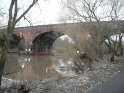
After joining the river bank, it was a case of following the new cycle-path along it , to the viaduct that carried the 'Methley Joint Railway, passing under Stephensons viaduct

Both taken; Tuesday 13th March 2018
DSCF4466.JPG DSCF4471.JPG

At the 'MJR' viaduct, there was a gentle incline up to join it, with the route followed over the river

Now surfaced; http://www.geograph.org.uk/photo/2163227
After the bridge, but substantially drier yesterday; http://www.geograph.org.uk/photo/3857110

This was followed for a mile or so, until a deviation was enforced by the Castleford - Leeds line, as the bridge taking this line, over that had been removed, so a couple of old railway properties were passed
This one in opposition to the camera angle; http://www.geograph.org.uk/photo/2163294

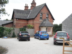
Then the old 'Methley South' station was encountered, now a private house (I remember this being derelict)

DSCF5681.JPG


At this point, there was a need to follow the roads through a new-ish housing estate, but with the bonus of the old Station House; http://www.geograph.org.uk/photo/3468676

Barnsdale Road was rejoined - an odd name, as it's got no connection, or even near the (Roman) road from Barnsdale Bar, to Castleford

Under the railway (Leeds - Castleford) at Pinders Bridge, onto WaterGate
My view, with a left after it; http://www.geograph.org.uk/photo/149748

After a short ride along WaterGate, before reaching the 'Mex' , it was a turn off to the left onto the 'Trans-Pennine Trail'
I rode towards the camera; http://www.geograph.org.uk/photo/2014400

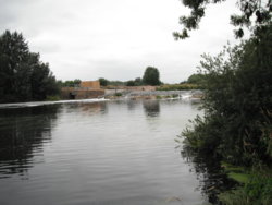
A slight deviation here, to go & Look at Penbank Weir, as I'd only ever seen it from the other side (& the canal was between us)
There is an 'abandoned' lock here
http://www.geograph.org.uk/photo/2014287
http://www.geograph.org.uk/photo/2014283

DSCF5699.JPG


Back down off the Flood Banking took me back to the 'T-P T' & onto the railway, towards the M62; http://www.geograph.org.uk/photo/2014395

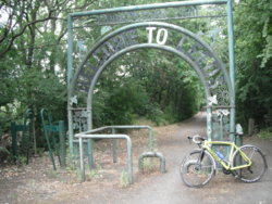
Just prior to passing under it, a nice piece of metal work appears, with the M62 crossing over the 'line' literally yards behind me

Seen here, from the other side of the M62; http://www.geograph.org.uk/photo/2014436
LeedsBradford to the left
Castleford/Pontefract/A1 to the right
DSCF5708.JPG


After passing under the M62, it was a fairly good 'road', barring the odd root breaking through the tarmac
A deviation was encountered, as there was another missing bridge deck, this one was missing back in the mid 90's though, & the 'middle is practically wall to wall vegetation now!
!http://www.geograph.org.uk/photo/2014264


On Bottomboat Road, I spotted this charming sundial on one of the terraced houses


Once the ascent was made, passing the point where the ' MJR' would have crossed on a bridge, it was onto Aberford Road, towards Stanley itself
Past the site of the demolished St Peters Church (mining subsidence got the better of it), & the local Cinema (as was...) 'Clog And Rhubarb' 2

http://www.geograph.org.uk/photo/966696


Down Aberford Road, further, to the junction with Lime Pit Lane, then a left onto a ' T-P T' section , known locally as the 'Naggers'
http://www.geograph.org.uk/photo/2478165
DSCF5738.JPG

Onto Ferry Lane, by the Marina, & bridge over the Calder
Than over the Aire & Calder Navigation Canal, & a sharp right
A gradual left took me onto the banks of the Calder, heading upstream, along the route of a colliery railway that delivered coal to the 'Ferry' for transport to Goole ,via a system known as 'Tom Puddings'
B & W photos, down the page; http://www.stanleyhistoryonline.com/Ferry-Lane-Photos.html


Once the site of the old Stanley Lodge was reached; a gate-house to NewLands Hall
7th, & 8th, photos down; http://www.stanleyhistoryonline.com/Newland-Estate.html
DSCF5739.JPG
I started the climb up to the Summerhouse site, quite a sharp climb that tests some of the local MTBers, but a steady plod in 34 x 25 made it, barring one small rocky section (remounted afterwards) http://www.geograph.org.uk/photo/2090857
DSCF5740.JPG

At the top, the remains of the summer house are littered with modern louts rubbish


There's a 'swoopy' singletrack through the Plantation on the top, & as I was on the CGR, & running '28' tyres, I had to take it steady, & thus noticed a pair of gate-posts
I think these may have been one of the carriage-entrances to the estate, with a particular approach to give a view over the Valley?


One last bridleway, following a (known) carriage-drive to Newlands Hall was followed, with parts of the estate wall still standing


From here, it was a pootle back along NewLands Lane, past the 'Pylon Pond' to rejoin Wakefield Road, by the Catholic Church, & home - dusty but happy in my exploring
http://www.geograph.org.uk/photo/3516021


I hope that this entertained/educated(?) at least one person??
If so, it was worth my while typing it out


1
Nothing to do with religion, but in the days of private Collieries/Pits, the local ones were owned by Messrs Pope & Pearson
2 The cost of building it, & the land, were donated by local Rhubarb growers & W Lambs Footwear (who made..... Clogs, initially)
 

colly

Re member eR
Location
Leeds
The first day of the rest of my life...............................actually the first day of a week in North Fumble Land.
Travelled up yesterday and today had one or two things organised so went out at around noon for a couple of hours.
The frozen north it is not, it's bloody hot I can tell you.
So it was a few miles on the cycle track from Alnmouth the Warkworth. (Sustrans Route Number 1)
20180722_121240.jpg

20180722_121340.jpg


Croquet island in view:
20180722_121510.jpg


and a view back towards Alnmouth:

(which didn't post so I'll stick it on another time)


Warkworth arrived and I took a couple of pics of the older bridge:

20180722_123241.jpg

20180722_123333.jpg

20180722_123503.jpg


and one looking south across the bridge with Warkworth Castle in the back ground over the town.

20180722_123525.jpg


From there it was inland a bit to Acklington and Felton (looks like a good place for a picturesque pub lunch laet in the week ):okay::okay::smile:


Then back to where I'm staying via Shilbottle and Hipsburn.

20180722_135656.jpg


Apologies for the ropey photos.:sad: The thing is with phone cameras, in the sunshine you can see rock all of what you are taking.

So it was a nice but hot and sweaty jaunt out of 23.4 miles with around 1300ft or so of uphill.

View: https://ridewithgps.com/trips/25811891


I have planned a couple of long rides this week but given how hot it is I think I'll have to be setting off early am so as to avoid the hottest part of the day.
Quite something for our country. :okay:
 

Attachments

  • 20180722_121518.jpg
    20180722_121518.jpg
    178.7 KB · Views: 45

SpokeyDokey

67, & my GP says I will officially be old at 70!
Moderator
Wasn't expecting much after having a colonoscopy yesterday, feeling rather tender and rather empty at the moment :blush:

Anyhoo, I was pleasantly surprised with the effort I put in and really enjoyed my, (not so), little self :bicycle:

LINKY

Hope all was ok. Lovely Wife had her 'over 55' bowel screen a couple of weeks ago and she had a sore tummy for a couple of days.
 

SpokeyDokey

67, & my GP says I will officially be old at 70!
Moderator
Today did not go as planned. :sad: Had 37 mile route mapped out and memorised in my old bonce.

But... I got up late due to going to bed at silly'o'clock. Dossed around for a few hours Kindling (good book about Pablo Escobar) and then scooted over to Evans for new Bibs as my old ones gave up the will to live on yesterday's ride. Time moved on...

Then had some late lunch and settled down to watch TdF (jeez - what a dull days racing that was) and I dozed off at the 50k to go mark. Woke up and saw the three man sprint finale and then watched the GC mob trundle in.

Then I had a 'shall I shan't I go' moment and I decided that a go was in order. Just a v.short 13 miles but crikey was it humid. When I took my jersey off it was sodden - yuk! Lovely Wife had to drag it off over my head as it was stuck to me - bless her!

Upsides: a short ride is better than no ride as we all know and my new Bibs (now having the first of hopefully many sessions in the washing machine) were very comfy.

Downsides: got a flying thing in my mouth and another in my ear - one ejected and one prised out. xx(
 

Glow worm

Legendary Member
Location
Near Newmarket
A couple of similar rides on my local patch yesterday and today.

FCF19195-F461-40E0-AD36-A098F234B934.jpeg


One of my favourite droves near Reach yesterday.

D8C9C3CE-57B4-49C9-93C3-574A0AD67895.jpeg


Reach Lode from the bridge.

70635D6B-0673-4A40-83D9-710AB4FC005F.jpeg


And today, a little more cloud but still warm. This is Harrison’s Drove at Wicken Fen.

B7663239-D027-48CA-8F9D-E19D7C28F7EE.jpeg


Further along I popped into the bird ringing hut at Wicken. Was trying to take a pic of my bike when the zoologist and this bloke got in the way! No idea who he is.

9C40D0B9-7A07-4DC6-892F-1D2B4A7F57EE.jpeg


Chris Packham was great. Time for everyone who spoke to him. I wish I had one hundredth the knowledge he has. Top bloke.

14F2B480-0F64-465E-95A8-10945C0F4873.jpeg


Then on home past Burwell Lode.

C51045D5-BE4D-4AFE-BF27-35F6051E656E.jpeg


Nearly home, past the barley. Looks ready to go to me.

A nice easy 18 miler here today (10 yesterday).
 
Last edited:

C R

Guru
Location
Worcester
I was out early to beat the heat as well. Plan today was to try a metric half century, with an extension of my Defford-Eckington-Pershore around Bredon Hill.

Set off at about quarter to seven, and there were two hot air balloons coming our way from the Worcester side. Started up Hatfield Bank, then Stonehall
Common, Pirton and past Croome at at reasonable tick. The balloons were tracking my route up to this point, but around Defford one of them started drifting eastwards, while the other followed on my route towards Eckington.

Past Eckington carried on straight instead of the usual left, skirting Bredon Hill, and then a left just before Bredon towards Westmancote. From here it is a steady climb to Conderton, and then a swift descent to Beckford. My seventh and eighth gears got a longer than usual tour of duty going down this way, though I was holding back a bit as I don't know the road, still reasonably quick, though.

In Beckford I missed the turn for Ashton under Hill, and ended up at the A46 junction, so had to retrace back to the Ashton turn, luckily it didn't add a lot to the route. From here it was up again past Ashton, up to just before Elmley Castle, where the descent towards Pershore starts.

Stopped for a drink, a nut bar and a breather in Elmley Castle, and once refreshed started the run for Pershore. This was fairly quick, and seven and even eight got a good turn again.

Arriving at Pershore got a sqweeky bum moment. Some guy walking his dog decided to cross the road to pick something from the hatched area in the middle, and crossed back without looking, only realising I was coming once he heard my tyres sliding in the tarmac. He did look quite surprised and did say sorry, luckily my brakes are good. The whole thing was so bizarre that I didn't even think of ringing my bell.
Today must have been the suicidal pedestrian day, as I got two more that saw me coming, made eye contact and still crossed the street, which again required evasive action, though I was prepared after the previous episode.

The ride through Pershore was otherwise nice, except for the Holloway climb to Rebecca road, it is not very long, but the bastard is a bit steep, and today my legs were feeling the strain. Luckily after an up there is a down, and this is a longish one that lets the heart rate settle back down.

Down Rebecca Road, then a right to Crabbe Lane, past Wadborough, and then Littleworth and down past Norton church for home.

34.5 miles in 2 hours 31 minutes at 13.7 mph. Mapmyride says 1300 feet of up, but I don't think it is anywhere near that much.

So, 55.5 km makes my first metric half. It was fun, but I am shaggered, though not absolutely shaggered. I will have to try and repeat the feat next month.
 

Jenkins

Legendary Member
Location
Felixstowe
Despite a late night following a very enjoyable family meal yesterday, I was woken up around quarter past six this morning thanks to the wildlife in the neighbour's trees. Couldn't get back to sleep so, after a mug of coffee and a large bowl of porridge I was out of the house just before half past eight. Warm, but a light breeze once out in the coutryside making it a very comfortable ride thanks also to the cloud cover - I even felt a couple of very small rain drops at the start but nothing more than that.

Out through Levington & Nacton into Ipswich and out of town through Sproughton back into the countryside of Burstall, Elmsett & Whatfield, then turning back towards Ipswich at Naughton through Offton & Somersham into Bramford where I headed northbound and away from Ipswich again to Claydon. Out to Coddenham and turned for home through Henley, Westerfield and the usual villages en route.

Home a few minutes after midday (which is when I'd normally be setting out!) with 66 miles completed and spent the afternoon vegging in front of the TV with the German Grand Prix on.

https://www.strava.com/activities/1719963885
Screenshot_2018-07-22 Powered by Pizza Ride Strava.png
Screenshot_2018-07-22 Powered by Pizza Ride Strava(1).png
 

13 rider

Guru
Location
leicester
I was out early to beat the heat as well. Plan today was to try a metric half century, with an extension of my Defford-Eckington-Pershore around Bredon Hill.

Set off at about quarter to seven, and there were two hot air balloons coming our way from the Worcester side. Started up Hatfield Bank, then Stonehall
Common, Pirton and past Croome at at reasonable tick. The balloons were tracking my route up to this point, but around Defford one of them started drifting eastwards, while the other followed on my route towards Eckington.

Past Eckington carried on straight instead of the usual left, skirting Bredon Hill, and then a left just before Bredon towards Westmancote. From here it is a steady climb to Conderton, and then a swift descent to Beckford. My seventh and eighth gears got a longer than usual tour of duty going down this way, though I was holding back a bit as I don't know the road, still reasonably quick, though.

In Beckford I missed the turn for Ashton under Hill, and ended up at the A46 junction, so had to retrace back to the Ashton turn, luckily it didn't add a lot to the route. From here it was up again past Ashton, up to just before Elmley Castle, where the descent towards Pershore starts.

Stopped for a drink, a nut bar and a breather in Elmley Castle, and once refreshed started the run for Pershore. This was fairly quick, and seven and even eight got a good turn again.

Arriving at Pershore got a sqweeky bum moment. Some guy walking his dog decided to cross the road to pick something from the hatched area in the middle, and crossed back without looking, only realising I was coming once he heard my tyres sliding in the tarmac. He did look quite surprised and did say sorry, luckily my brakes are good. The whole thing was so bizarre that I didn't even think of ringing my bell.
Today must have been the suicidal pedestrian day, as I got two more that saw me coming, made eye contact and still crossed the street, which again required evasive action, though I was prepared after the previous episode.

The ride through Pershore was otherwise nice, except for the Holloway climb to Rebecca road, it is not very long, but the bastard is a bit steep, and today my legs were feeling the strain. Luckily after an up there is a down, and this is a longish one that lets the heart rate settle back down.

Down Rebecca Road, then a right to Crabbe Lane, past Wadborough, and then Littleworth and down past Norton church for home.

34.5 miles in 2 hours 31 minutes at 13.7 mph. Mapmyride says 1300 feet of up, but I don't think it is anywhere near that much.

So, 55.5 km makes my first metric half. It was fun, but I am shaggered, though not absolutely shaggered. I will have to try and repeat the feat next month.
Well done on your longest ride :thumbsup: now you got one under your belt ,how about the 2019 edition of https://www.cyclechat.net/threads/the-2018-half-century-50km-or-50-mile-a-month-challenge.228549/ bit of time for some training and away you go
 

derrick

The Glue that binds us together.
A couple of good rides this weekend, Saturdays ride was a hard one, Mates birthday Friday all down the pub till closing time, Had a bit of a hangover Saturday morning, but three of us set out looking for a new route, Most of it was good country lanes but towards the end the roads got a bit busy, the hangover went after a couple of hours, then i started to feel a bit better.:laugh:
https://www.strava.com/activities/1717207007
Sunday we decided to go in the same direction as Saturday,for the first 20 or so miles, but then we headed out Essex way, Found some new lanes that zig zagged across routes i know, Stopped at a couple of pubs on the way round, first one for a nice cold beer, the second one for a bit of lunch. Had one of the best sandwiches i have ever had, nice freindly staff as well. 125 miles for the weekend, another great weekend.
https://www.strava.com/activities/1720339481
 

C R

Guru
Location
Worcester
Decided to do the Sigma Sport Rideyesterday
This bike shop in Hampton Wick do these occasional rides

So first job was to cycle over there. Due togetting ready a bitto slowly I had to rush. I eneded up doing the 12 miles at 18.7 mph- it is flat though.

Course was back almost to my door step then through Knaphill Farnborough and Tongham
Then a stop at Seale Tea omms, then the hilly climb up the Hog's back at Wanborough,
WE headed back and my intention was always to peel off a a certain point to ead home. Well I missed an opportuity or two. Then Someone stoppped for a puncture, and suddenly found I had one too. Think it was a pothole.

I eventually veered off at Cobham and wenr via Brooklands and Chertsey back home.

This group was said to be the slowest group, speed was said to be 15-16 mph. Haha!

Having got home I found my total distance was 74 miles at an average speed of 17.7 mph. Unprecedented speed over that sort of distance for me.. I did ride about 25 miles of that on my own, but no difference in speed there either..
1683 feet climbed.

https://www.strava.com/activities/1719975941
 

skudupnorth

Cycling Skoda lover
A couple of similar rides on my local patch yesterday and today.

View attachment 420626

One of my favourite droves near Reach yesterday.

View attachment 420627

Reach Lode from the bridge.

View attachment 420628

And today, a little more cloud but still warm. This is Harrison’s Drove at Wicken Fen.

View attachment 420629

Further along I popped into the bird ringing hut at Wicken. Was trying to take a pic of my bike when the zoologist and this bloke got in the way! No idea who he is.

View attachment 420630

Chris Packham was great. Time for everyone who spoke to him. I wish I had one hundredth the knowledge he has. Top bloke.

View attachment 420631

Then on home past Burwell Lode.

View attachment 420632

Nearly home, past the barley. Looks ready to go to me.

A nice easy 18 miler here today (10 yesterday).
Wicken Fen is on my to do list this year,looks fantastic
 

skudupnorth

Cycling Skoda lover
Not going to bore you with my new found enthusiasm with Route 55 but I will like to show you the other end of the route which connects to the Trafford Park area near the Manchester Ship Canal. Once you ride to the end of Route 55 at Monton near Eccles,you have a short walk over the canal bridge to join the Bridgewater Canal and the Bridgewater way which opens up links to the city centre or further into Cheshire. One part I have been meaning to explore is the new lift bridge which has been built over the ship canal next to the original Barton Bridge. After a delay in opening,the bridge is now up and running and links from the swing bridge at Dumplington ( it is a real name ! ) or the Rugby stadium thingy near Barton aerodrome which has many shared paths that have been created when the roads were improved. Enjoy the photos
DSCN1904.JPG
DSCN1905.JPG
DSCN1906.JPG
 
Top Bottom