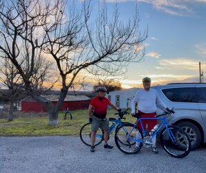
Your ride today....

Page may contain affiliate links. Please see terms for details.

Jameshow

Veteran
Cafe ride ended up being 40 miles instead of 35 due to flooded roads forcing a U-turn. We did a couple that were 6" deep (feet dipping underwater; they were far, far too long to coast through so pedalling was required). The bit by the Thames at Waterhay defeated us, though, as it was very deep, murky, hundreds of yards long, and the wind was whipping it up.

This oldish video gives you an idea what it was like down there, but it's more frightening than this with waves on it.


View: https://youtu.be/K5kSD1BzeT0


We were heading the opposite way, so hit the long section first. Got about 50 yards into it and did a quick twizzle around.


Love the flood sign...!

Chelsea tractor not!!
 

C R

Guru
Location
Worcester
First proper ride since early December. The forecast was windy but dry, so a ride was on, with a route that should take me out into the wind, but hopefully with some tail wind on the way back.

Out at about quarter past six heading towards Kempsey, still dark and with quite a strong headwind. Had to work hard to keep a reasonable speed, which wasn't easy with my lack of fitness.

After Kempsey headed for Upton via the back lanes through Kinnersley and Earls Croome. The hedges provided some shelter in places, but out of the shelter cycling against the wind was like going up a 10% incline. To top the discomfort, it felt like it might start raining at any moment. I briefly considered looping back via Defford, but I was out and I wasn't going to abandon the ride.

Past Upton the threat of rain disappeared, and the wind was on the side, so progress was easier, but I had to keep my wits about to stop the gusting wind from blowing me into the ditches. Some colour was starting to show in the horizon, and I could see the fields around the road fully flooded.

Once I got to Long Green and turned towards Tewkesbury I finally had a tail wind, and made the distance to Mythe Bridge fairly quickly. The Severn flood plain is flooded here, with some interesting views from the causeway in the pre dawn light
20230115_073227.jpg


20230115_073521.jpg


The river is as full and fast as I have ever seen it here
20230115_074032.jpg


Next destination was Bredon, with the wind still behind, and then head for Eckington. The Avon has flooded its plain too, and Eckington Bridge is closed, so I took the road along the Bredon Hill flank to the Combertons.

The view from the highest point includes the flooded plain between Eckington, Defford and Strensham.
20230115_082145.jpg


20230115_082404.jpg


Next was the descent to Great Comberton, where a pigeon flew straight at me, possibly driven by the wind, only managing to avoid each other at the last minute.

I made it to Pershore without further incident, and stopped at the old bridge for a breather and a couple more photos of the flood.
20230115_084030.jpg


20230115_084058.jpg

My legs were complaining now, and was back against a headwind now, so I was taking it easy. The last bit would take me through the ford at Walcot Ln, which I was hoping would still be passable on foot. The brook was very full, but still about 10cm below the walkway, so fine for me, but not fine for the car that was being pulled out of the ford. This is quite a dangerous ford at the best of times, and someone died in here during the 2007 floods, so I really can't understand why anyone would try to cross it in the current conditions.
20230115_085352.jpg


20230115_085547.jpg

The final miles were a real slog, and when I finally got home it was a relief, but I'm glad I was out.

The map
Screenshot_20230115-222206_Connect.jpg
 

cwskas

Über Member
Location
Central Texas
The first approximately 20 miles of my Saturday ride with Charlie was on the roughest paved road I think I have ridden. I have been on this stretch before, so maybe I am just becoming a wuss. I am riding smaller tires on the trike now with more air pressure. Winds were out of the south at 20 mph with gusts to 28. I was quite tired by the return.

A museum recreated from one of the early Norwegian settlers home.
The exterior rocks are almost all original, but the inside was restored using pictures of the original .

20230114-Charlie-2.jpeg

I find signs to ranches often amusing
20230114-Charlie-3.jpeg


A beautiful day despite the wind
20230114-Charlie-4.jpeg


20230114-Charlie-5.jpeg


20230114-Charlie-6.jpeg


20230114-Charlie-7.jpeg


By this time we had skipped our planned rest stop since the rough portion had taken longer than anticipated.
We had a fine stretch of rollers with a nice tailwind. I couldn't resist this wonderful sunset.
20230114-Charlie-8.jpeg


There were 9 deer across the road. This was taken from the same spot as the sunset shot.
20230114-Charlie-9.jpeg


20230114-map.jpg
 

cwskas

Über Member
Location
Central Texas
Sunday was a bit windier and out of the south again. I decided to see if I could manage an extended 'real road ride' on the Surly. I have only been riding shorter distances and on very smooth rarely used roads. Charlie agreed to return for me if I couldn't complete the task, so off we went.

About a quarter of a mile in, he mentioned that my tail light was not working. I remembered turning it on. As I slowed to a stop, I had trouble unclipping my left pedal and over I went. I had a nice soft landing except for my right palm at the base of the thumb. It gave me fits the whole ride, but was manageable.

I have balance issues even walking or sometimes just standing still. My main concern with going back to a real bicycle was the starting and stopping. But I had 5 additional starts and stops and managed those. Several of the climbs were pretty hard for me, but I managed them as well. I was quite tired when we finished, but very glad I had taken the leap.

No pictures from this trip, I was too busy. But it was on some of my favorite roads.

20230115-map.jpg
 

Rickshaw Phil

Overconfidentii Vulgaris
Moderator
Yesterday: I thought I'd do a bit more flood sightseeing and head over to Crew Green to see what it was like there. I planned a more direct route than I usually would, heading over Lyth Hill then to Exford's Green, Arscott, Lea Cross, Edge, Stoney Stretton and up the long straight to Westbury before climbing over the hill at Bulthy and dropping into Crew Green. It was a bit blustery so i didn't expect quick progress. It was also quite cold so I had the winter layers on which didn't help much either.

It was a fairly uneventful trip over, apart from being overtaken by a Triumph TR7 near Annscroft - I haven't seen one of those for a while. Not many other cyclists out, but there were a few people walking to say hello to. On the way to Bulthy the lane seemed to have more traffic than I'd usually expect, which I guessed was due to people trying to find alternative ways around the roads that were under water. On the descent into Crew Green the flooding looked quite impressive.

When I reached the main road at the bottom of the hill I turned towards Llandrinio and though I'd see how far I could get. The answer was; not very far, but further than I thought it might be. I paused for photos and was surprised to hear a couple of vehicles coming up behind me. They splashed through the first small flood but baulked at going into the flooding proper (very sensible) and had to turn back. As they were headed back up the road another car approached and this one actually started wading into the flood before the driver thought better of it.

Turning back myself I headed towards Melverley next. The flood plain at the bridge was quite a sight then shortly afterwards the road was covered so I didn't dare go further. Heading for Coedwy next, the road was fairly quiet but ther were still a few vehicles headed towards Crew Green. The legs were a bit tired climbing the hill at Prince's Oak so I knew progress on the way back wouldn't be much better.

Getting back to Westbury I thought I'd vary the route back so headed towards Asterley then via Farley to Pontesbury, Plealey, Exford's Green and Hunger Hill. I'd hoped to have a good tailwind for much of this but it seemed to have died down since earlier in the ride.:rolleyes:

I toyed with the idea of taking the flat way home but instead opted for the shorter but hillier way through Little Lyth as I'd already been out longer than intended.

Just over 38 miles this time at 11.7 mph average.

20230115_133206_Richtone(HDR).jpg

Today's view from Lyth Hill. Hopefully the smoke down there was just a bonfire.

20230115_141503.jpg

At Westbury.

20230115_144652_Richtone(HDR).jpg

Dropping down the hill into Crew Green gave a great view of the extent of the floods.

20230115_145430_Richtone(HDR).jpg

On the road to Llandrinio I hadn't expected these two to try their luck with the closure.....

20230115_145454_Richtone(HDR).jpg

....... They've thought better of it.

20230115_150351.jpg

The bridge between Crew Green and Melverley. The water level would have been practically touching the bridge a couple of days ago.

20230115_150458.jpg

The confluence of the rivers Severn and Vyrnwy is under there somewhere.

20230115_150840_Richtone(HDR).jpg

Oops! I'm guessing that this happened when the water level was at its highest and the driver couldn't tell where the tarmac was.

20230115_152440_Richtone(HDR).jpg

On my way back now and looking towards the Breidden.

20230115_154820_Richtone(HDR).jpg

The view before I descend to Asterley.
 

bluenotebob

Veteran
Location
France
Nippy here today – and still a gusty wind – but sunshine (at last) so … another two hour afternoon meander through the local countryside, stopping quite often to take photos and enjoying a dry ride for a change.

Up to St Brieuc-de-Mauron (SBdM), then a loop out to la Plaisance, back into SBdM, then north through Brignac (stopping briefly at the étang de la Maladrerie) and up to the little chapelle de la Riaye. West from la Riaye through le Villot to connect with the Ménéac to Brignac road near Grand Guénan. Home via la Corbinais, Kerminy and SBdM.

It got colder as the afternoon progressed – I’m not sure if the wind was starting to turn to the north (it wasn’t obvious) – so a big fire was lit as soon as I got home.

A really enjoyable 31km – so nice to see the sun – but it would have been even nicer if it hadn’t started to turn so bitterly cold.

Near la Plaisance

Horse near Plaisance pic 2.JPG


On the road towards Brignac

Road to Brignac from SBdM pic 1.JPG


The étang de la Maladrerie just outside Brignac

Etang de la Maladrerie pic 1.JPG


The chapelle de la Riaye

Chapelle de la Riaye Pic 4.JPG


The road towards la Corbinais from Grand Guénan

Road to Brignac from Ménéac pic 1.JPG
 

gavgav

Legendary Member
Yesterday: I thought I'd do a bit more flood sightseeing and head over to Crew Green to see what it was like there. I planned a more direct route than I usually would, heading over Lyth Hill then to Exford's Green, Arscott, Lea Cross, Edge, Stoney Stretton and up the long straight to Westbury before climbing over the hill at Bulthy and dropping into Crew Green. It was a bit blustery so i didn't expect quick progress. It was also quite cold so I had the winter layers on which didn't help much either.

It was a fairly uneventful trip over, apart from being overtaken by a Triumph TR7 near Annscroft - I haven't seen one of those for a while. Not many other cyclists out, but there were a few people walking to say hello to. On the way to Bulthy the lane seemed to have more traffic than I'd usually expect, which I guessed was due to people trying to find alternative ways around the roads that were under water. On the descent into Crew Green the flooding looked quite impressive.

When I reached the main road at the bottom of the hill I turned towards Llandrinio and though I'd see how far I could get. The answer was; not very far, but further than I thought it might be. I paused for photos and was surprised to hear a couple of vehicles coming up behind me. They splashed through the first small flood but baulked at going into the flooding proper (very sensible) and had to turn back. As they were headed back up the road another car approached and this one actually started wading into the flood before the driver thought better of it.

Turning back myself I headed towards Melverley next. The flood plain at the bridge was quite a sight then shortly afterwards the road was covered so I didn't dare go further. Heading for Coedwy next, the road was fairly quiet but ther were still a few vehicles headed towards Crew Green. The legs were a bit tired climbing the hill at Prince's Oak so I knew progress on the way back wouldn't be much better.

Getting back to Westbury I thought I'd vary the route back so headed towards Asterley then via Farley to Pontesbury, Plealey, Exford's Green and Hunger Hill. I'd hoped to have a good tailwind for much of this but it seemed to have died down since earlier in the ride.:rolleyes:

I toyed with the idea of taking the flat way home but instead opted for the shorter but hillier way through Little Lyth as I'd already been out longer than intended.

Just over 38 miles this time at 11.7 mph average.

View attachment 674597
Today's view from Lyth Hill. Hopefully the smoke down there was just a bonfire.

View attachment 674598
At Westbury.

View attachment 674599
Dropping down the hill into Crew Green gave a great view of the extent of the floods.

View attachment 674600
On the road to Llandrinio I hadn't expected these two to try their luck with the closure.....

View attachment 674602
....... They've thought better of it.

View attachment 674603
The bridge between Crew Green and Melverley. The water level would have been practically touching the bridge a couple of days ago.

View attachment 674604
The confluence of the rivers Severn and Vyrnwy is under there somewhere.

View attachment 674605
Oops! I'm guessing that this happened when the water level was at its highest and the driver couldn't tell where the tarmac was.

View attachment 674606
On my way back now and looking towards the Breidden.

View attachment 674608
The view before I descend to Asterley.

A serious absence of brain cells amongst those drivers 🤷‍♂️
 

cwskas

Über Member
Location
Central Texas
Just 20 miles today on the Surly . . . more conditioning and a bit more test of my climbing ability. The plan was for 30-35 from Charlie's house, but he had a flat right after we left his gate and ended up having to change the tube. It gave me a chance to tweak my seat position a bit more aft and that seemed more comfortable. Still windy today. Tomorrow looks more promising.

20230116-Charlie.jpeg
 

C R

Guru
Location
Worcester
It was gloriously bright day today, if a bit cold, and No Wind! so I couldn't resist a lunchtime loop. Dressed up warm, it didn't feel took cold in the sunshine, but the shade was not that pleasant. No ice on the lanes I took, just a couple of places with slush from deep puddles disturbed by traffic. It felt great being out, and my fitness is slowly building up.

Screenshot_20230117-171321_Connect.jpg
 

Donger

Convoi Exceptionnel
Location
Quedgeley, Glos.
Almost my favourite riding conditions this morning. Almost. If there hadn't still been patches of ice across the road in places it would have been crisp, cold, clear and only just ice-free. I did have my doubts about riding on ice during an ambulance strike, but I took extreme care and kept the speed down and my fingers off the brake levers every time I spotted a sheen on the road. As usual in these conditions, I asked myself whether my old school would have made me play rugby in this. I reckoned they would have, so this was a go. Added to that, I am on holiday on the Gower, and I won't get that many more opportunities to ride this far West in Wales, so what the hell. A few years back I'd ridden out to Worm's head at Rhossili, sticking to the South side of the Gower. Not having much time, as I promised my wife I'd be back by 12.00, I drove out to Three Crosses and did a little ride out along the North side of the Gower to Llanrhidian and Weobley Castle and back.
16. Setting out from Three Crosses.JPG

I deliberately chose a little minor lane, as the bigger B road along the peninsula was a real rat run full of mums on the school run when I arrived. In the end it was a good choice, as I went about 7 miles meeting only one vehicle - a tractor, and I was able to ride really carefully and slowly along the crown of the road.
17. View towards Llanelli and Burry Port.JPG

It was mostly heathland, with distant views over Llanrhidian Sands towards Llanelli, Burry Port and the Gwendraeth.
18..JPG

A lovely empty road meant I could stop wherever I wanted to and take a few pictures.
19. Welsh Moor.JPG

At various points today I had to slow down for cattle, sheep and horses that roamed freely around the unimaginatively named "Welsh Moor". One of these cattle was a bit spooked at the sight of me and gave me a bit of a start when it frisked about in the road in front of me. My turning point on this ride was when I reached a spot with a good view of the ruins of Weobley Castle.
20. View of Weobley Castle and Llanrhidian Sands.JPG

For my return, I stuck to the B road after passing through Llanrhidian, as the morning traffic had died down to a trickle. I don't know why it came as a surprise that the return was mostly uphill, as I'd clearly just descended down off the moor, but I reckon two thirds of the return trip must have been uphill - though never particularly steep. A bit of Welshness for you:
22..JPG

I have to say that I'm glad I didn't have to go back over that icy lane again on my return. And it turned out it was quite a nice route back over the moor. This time it was horses I had to look out for.
24. Road to Three Crosses.JPG

I've just realised there are no bike pics today, so you'll have to make do with a selfie instead!
23..JPG

Another really enjoyable holiday ride to add to my Swansea Bay ride the other day. Really getting my love of cycling back. Only 14 miles, but nice to get another morning ride in before taking Mrs D to lunch at the Lighthouse Bar and Kitchen opposite the Mumbles Lighthouse. I'm definitely going to get at least one more ride in before we leave. I fancy repeating that trip around Swansea Bay.
 
Last edited:

buzz22

Über Member
20230117_120626.jpg

I finished work yesterday morning and felt like a ride when I got home.
New tyres on one of my old Giant CFR3's made the choice of bike easy, the new tyres needed a test ride.
My normal circuit along the highway out to Waterfall and back for just over 30km then back out again for another lap saw a bit over 60km.
Far enough to show that 25mm tyres (the biggest this bike will take) ride nicer than 23's and that there's a reason I have Maxxis Refuse's fitted to a few of my bikes. Not the fastest tyre around but very durable and good grip.
 

bluenotebob

Veteran
Location
France
It snowed here overnight. It had been forecast for yesterday and I thought we’d escaped.. but no. I did a short ‘photo trip’ on one of my mountain bikes, then went out for a longer ride. The snow had started to melt by early afternoon and the roads were quite slushy – then it rained heavily, stopped and then there was a hailstorm, then the temperature dropped like a stone. I managed a third ride late in the afternoon but it had become too cold to be remotely enjoyable. Only 20km in total today but I got some nice photos.

Here are a couple of photos from my first ride of the day

Pink road snow pic 1.JPG


Snowy fields pic 1.JPG
 
Top Bottom