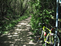
Bike selected; CGR (as I was heading into the woods, & MTB trails)
Weather; sunny, cool, dry, breezy
Photographs from today (unless captioned otherwise)
Just a local potter
At no point, was I more than 2miles from the house! (I know where a mile is, when running the main portion of my 'out', from when I wore a GPS watch)
Out & onto NewLands Lane, behind the Catholic Church, past the Allotments, & the scrubland I used to run across, as the start of a XC loop
There's new track been laid under NewLands Bridge, primarily to get rid of a cross-over, as that siding's not been used for (probably) 20+ years
Not entirely certain about the work under the siding, unless it's to get track circuit cables through?
Past the old brickworks chimney, a few yards from the cutting (now used for phone masts);
https://www.geograph.org.uk/photo/3675566
Past the 'Pylon Pond';
https://www.geograph.org.uk/photo/2040381
Along NewLands Lane, towards the Woods & the remains of NewLands Hall;
https://www.stanleyhistoryonline.com/Newland-Estate.html
At the 'cross-roads'/junction (TPT), it was a left towards the old quarrys (now 'lakes')
https://www.geograph.org.uk/photo/191208
I approached from Normanton;
View: https://www.facebook.com/photo.php?fbid=10212718177781605&set=a.10211878570791955&type=3&theater
It was a clay quarry, but a lot of the surrounding area is now a sandy-soil, or seemingly pure sand
I had meant to follow a track at the far end of it, but a tree was down over it, a couple of hundred yards along; to the right
My bike's leaning on the post in the link;
https://www.geograph.org.uk/photo/2667765
I found out how sandy it all was, whilst riding back up, & taking the wrong line, at one point... ended up with sand over the rims
A change of a couple of feet got me going again
Then back to the 'cross-roads' (& straight over) onto the '
Miners Path'
Once at the top of the Plantation Woods, it was a sharp left into them & a matter of picking through untold amounts of tree-roots, to the 'Summer-House' (just a circle of stones, with no proof that's what it was) but its not marked at all, on the 1908 25" OS map
https://www.geograph.org.uk/photo/2091017
In the corner near the 'Summer-House' is a drop down to the site of Stanley Lodge (see the
Stanley History link above)
I rode down it steadily, braking intermittently, as it's about 3 years since I last used it, & there was a natural spring making it very wet at one point - now 'buried' under stones & bricks
So, once at the bottom, it was a case of turn round & stay in the saddle, choosing a line, crossing those ridges/roots and stones
(34 x 21?? - on a 12 to 28/10speed)
Not a single 'dab', but a few yards out of the saddle, just at the top, for a hump

Then back through the Plantation & back to NewLands Lane, via a different exit to how I entered the Woods
A short ride, but one that took energy & technique


 There aren't as many people out as there were at the weekend but still plenty taking their exercise. The bell got a bit of use and I needed to slow a few times until there was safe room to pass people walking. I counted 17 cyclists on the way round which is quite good going.