Richard A Thackeray
Legendary Member
Bike selected; CGR (as I knew I'd be on Canal towpaths, & in woodland)Weather; overcast. quite cold, mainly dry, intermittent Sun, breaking through the cloud
Photographs from today (unless captioned otherwise)
Out of the house, once temperatures had risen slightly, & the frost had gone from the direct sunshine
Cars were still white, where they were in shadow though
This was a 'Chuck Berry ride', in that I had no particular place to go
Up onto the road, over what is colloquially known as Common Road, but is officially Black Road (A655), after it's dropped down 'PineApple Hill' (there was pub at the top, now closed, & converted to a b-i-g house)
From the hill-top, there's a good view over the surrounding area, with vistas as far as HolmeMoss, the wind-farm at Royds Moor (north-west of Penistone), Midhope Moors, & the land to the north of LadyBower Reservoir
It was over Black Road, past the evocatively named Horse Race End Cottages (there is also a 'Horse & Groom' pub the other side of a 'Hall & Wings' late 16th century house)
http://www.geograph.org.uk/photo/1669765
The sign is on these cottages; http://www.geograph.org.uk/photo/3784591
View: https://www.facebook.com/photo.php?fbid=10208051604240183&set=a.10206883847206987.1073741862.1601508436&type=3&theater
Monday 4th April 2016
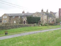
and left at the junction with Doncaster Road (A638), & an almost immediate right onto Oakenshaw Lane
This is a rather twisty. unsighted at times (for drivers) 'rolling' lane
However, I wasn't on it for long, as I turned off just before the Leeds-Wakefield-Doncaster-Kings Cross line was passed over
It was into the old Walton Colliery yard, passing a few Pit Cottages
http://www.geograph.org.uk/photo/3247149
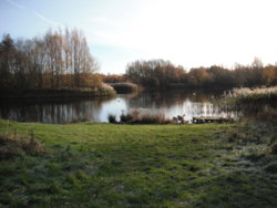
This was the Pit, but was redeveloped into a Country Park, with various small lakes, & the ('abandoned') Barnsley Canal passing through it
http://www.wakefield.gov.uk/sport-a...countryside/parks/walton-colliery-nature-park
I just gently meandered through, with no real intentions, and ventured onto a path, I'd not been on before
Some were a bit muddy, but fine on the Duranos of the CGR
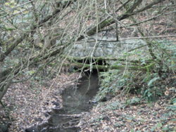
A culvert, under the railway embankment, & the bridge over the culvert
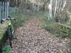
On reaching the car-park, at the end, & rejoining Shay Lane, I headed right towards Walton, climbing up to the New Inn, & Church, where the Barnsley Canal once crossed here, & the route has been followed before (but not reported on here)
At the junction with The Balk, it was a left turn towards Walton Hall
- the home of Charles Waterton, accepted founder of the Worlds first nature reserve
If I'd carried on over the canal bridge, I'd have seen his old Home, it has been a maternity hospital, now a fancy Hotel
http://www.geograph.org.uk/photo/3407997
http://www.watertonparkhotel.co.uk/hotel/history/
A right turn (due south) took me onto the old towpath, now Trans-Pennine Trail, with the aim of Wintersett/Cold Hiendley reservoirs (built to feed water to the Canal)
It's only in water at certain points, but how deep the mud/silt is, under the leaves could be a hazardous guess?
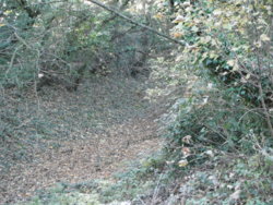
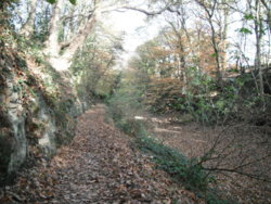
Once at the dam, of the reservoir, it was off to follow the trails around Haw Park Woods, back to the café/countryside center
http://www.wakefield.gov.uk/sport-and-leisure/parks-and-countryside/parks/haw-park-wood
I got talking to a chap there, who had brought his Scimitar out for a Sunday morning spin
He seemed happy that someone recognised what it was, & let me have a look
I followed the road over the edge of Wintersett, towards Ryhill, & turned right towards the hamlet of Cold Hiendley (15 - 20 houses??), with another nice 'hall & wings' house, that's split up, & on a farm
Then a bit of road, through Notton Bridge, over a George Stephenson designed roadbridge
https://www.britishlistedbuildings.co.uk/101135573-notton-bridge-notton#.WhGrI0x2vIU
http://www.geograph.org.uk/photo/75264
Straight over, at 'Twist cross-roads' (where there used to be a pub, called the Oliver Twist, now demolished, & houses there)
http://www.geograph.org.uk/photo/3245966
A short run, brought a rapid descent into the lovely village of Notton, where there's evidence in Applehaigh Woods, of Iron-age workings
Along George Lane, turning right (north) onto Woolley Mill Lane, where there's a very b-I-g house, that looks like a Colarado ski-lodge!, with the remnants of the Woolley Dam, as a private lake
Old details. but has pictures
http://www.rightmove.co.uk/property-for-sale/property-39158000.html
Out onto Barnsley Road here, the A61, not far south of NewMillerDam
A left onto Wood Lane, towards Chapelthorpe
Once in Chapelthorpe. I worked through the village, passing this lovely Hall
http://www.geograph.org.uk/photo/765760
Next stop was a fast road, Demby Dale Road, the dual-carriageway (at this point) out of Wakefield, to jct 39/M1
I had to join it at a roundabout, not too bad on a Sunday dinnertime, but a nightmare on a mid-week 'rush-hour'
(from the cameras angle too) http://www.geograph.org.uk/photo/2529228
Back towards Wakefield, feeling quite warm, but with numb toes
Past Pugneys Country Park, & over the River Calder, under the railway to Barnsley, & past Holmefield Park (Wakefield Park is three, really; Holmfield, Clarence & Thornes)
Under the '99 Arches (the railway we encountered on Oakenshaw Lane, at the beginning of this drawn out saga)
http://www.geograph.org.uk/photo/362217
Across Ings Road, an early bypass, to avoid drove Cattle clogging up the town centre (Ings being the marshy area)
Around past the site of the (old) Cattle Market, now the main Royal Mail sorting/distribution centre for the area
Round George Street, to Smythe Street, to come to the traffic-lights opposite the Opera House
http://www.geograph.org.uk/photo/942818
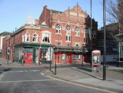
Designed by Frank Matcham, who was responsible for the London Palladium, amongst others, & the gorgeous County Arcade in Leeds
https://en.wikipedia.org/wiki/Theatre_Royal,_Wakefield
https://en.wikipedia.org/wiki/Frank_Matcham
Back home via, the BullRing, in the shadow of the Cathedral
http://www.geograph.org.uk/photo/464524
Past the converted Stanley Royd 'West Riding Lunatic Asylum' (as it was built for), onwards via the new 'Eastern Relief Road', & my usual route home, as I would to/from work
Including my daily view of the Worlds largest cast-iron aquaduct
http://www.engineering-timelines.com/scripts/engineeringItem.asp?id=19
As I wrote yesterday..............
I just gently meandered through, with no real intentions, and ventured onto a path, I'd not been on before
Some were a bit muddy, but fine on the Duranos of the CGR

A culvert, under the railway embankment, & the bridge over the culvert


On reaching the car-park, at the end, & rejoining Shay Lane, I headed right towards Walton, climbing up to the New Inn, & Church, where the Barnsley Canal once crossed here, & the route has been followed before (but not reported on here)
At the junction with The Balk, it was a left turn towards Walton Hall
- the home of Charles Waterton, accepted founder of the Worlds first nature reserve
If I'd carried on over the canal bridge, I'd have seen his old Home, it has been a maternity hospital, now a fancy Hotel
http://www.geograph.org.uk/photo/3407997
http://www.watertonparkhotel.co.uk/hotel/history/
A right turn (due south) took me onto the old towpath, now Trans-Pennine Trail, with the aim of Wintersett/Cold Hiendley reservoirs (built to feed water to the Canal)
It's only in water at certain points, but how deep the mud/silt is, under the leaves could be a hazardous guess?


Once at the dam, of the reservoir, it was off to follow the trails around Haw Park Woods, back to the café/countryside center
http://www.wakefield.gov.uk/sport-and-leisure/parks-and-countryside/parks/haw-park-wood
I got talking to a chap there, who had brought his Scimitar out for a Sunday morning spin
He seemed happy that someone recognised what it was, & let me have a look
I followed the road over the edge of Wintersett, towards Ryhill, & turned right towards the hamlet of Cold Hiendley (15 - 20 houses??), with another nice 'hall & wings' house, that's split up, & on a farm
Then a bit of road, through Notton Bridge, over a George Stephenson designed roadbridge
https://www.britishlistedbuildings.co.uk/101135573-notton-bridge-notton#.WhGrI0x2vIU
http://www.geograph.org.uk/photo/75264
Straight over, at 'Twist cross-roads' (where there used to be a pub, called the Oliver Twist, now demolished, & houses there)
http://www.geograph.org.uk/photo/3245966
A short run, brought a rapid descent into the lovely village of Notton, where there's evidence in Applehaigh Woods, of Iron-age workings
Along George Lane, turning right (north) onto Woolley Mill Lane, where there's a very b-I-g house, that looks like a Colarado ski-lodge!, with the remnants of the Woolley Dam, as a private lake
Old details. but has pictures
http://www.rightmove.co.uk/property-for-sale/property-39158000.html
Out onto Barnsley Road here, the A61, not far south of NewMillerDam
A left onto Wood Lane, towards Chapelthorpe
Once in Chapelthorpe. I worked through the village, passing this lovely Hall
http://www.geograph.org.uk/photo/765760
Next stop was a fast road, Demby Dale Road, the dual-carriageway (at this point) out of Wakefield, to jct 39/M1
I had to join it at a roundabout, not too bad on a Sunday dinnertime, but a nightmare on a mid-week 'rush-hour'
(from the cameras angle too) http://www.geograph.org.uk/photo/2529228
Back towards Wakefield, feeling quite warm, but with numb toes
Past Pugneys Country Park, & over the River Calder, under the railway to Barnsley, & past Holmefield Park (Wakefield Park is three, really; Holmfield, Clarence & Thornes)
Under the '99 Arches (the railway we encountered on Oakenshaw Lane, at the beginning of this drawn out saga)
http://www.geograph.org.uk/photo/362217
Across Ings Road, an early bypass, to avoid drove Cattle clogging up the town centre (Ings being the marshy area)
Around past the site of the (old) Cattle Market, now the main Royal Mail sorting/distribution centre for the area
Round George Street, to Smythe Street, to come to the traffic-lights opposite the Opera House
http://www.geograph.org.uk/photo/942818

Designed by Frank Matcham, who was responsible for the London Palladium, amongst others, & the gorgeous County Arcade in Leeds
https://en.wikipedia.org/wiki/Theatre_Royal,_Wakefield
https://en.wikipedia.org/wiki/Frank_Matcham
Back home via, the BullRing, in the shadow of the Cathedral
http://www.geograph.org.uk/photo/464524
Past the converted Stanley Royd 'West Riding Lunatic Asylum' (as it was built for), onwards via the new 'Eastern Relief Road', & my usual route home, as I would to/from work
Including my daily view of the Worlds largest cast-iron aquaduct
http://www.engineering-timelines.com/scripts/engineeringItem.asp?id=19
As I wrote yesterday..............
Day-off tomorrow, so I'll see what it brings for a ride
I hope, at least one person enjoyed reading this/opening the links/the photographs
The sentiments are the same
Last edited:


