Your bike on a bridge pics

Page may contain affiliate links. Please see terms for details.

PeteXXX

Cake or ice cream? The choice is endless ...
Photo Winner
Location
Hamtun
@PeteXXX i use it loads now and considering i never even knew it existed till we rode over it :laugh:
Must be due another ride soon ?
It's a handy cut through, especially with all that new industry spring up there!
Yes, but I'm not riding too much at the mo. Soon, hopefully :okay:
 

Spiderweb

Not So Special One
Location
North Yorkshire
Picture of my bike on the bridge that got washed away in the floods, Grinton Moor, North Yorkshire.

503323
 
Stanley Ferry Trash Screen Bridge
It's a few yards upstream of the aquaduct carrying the Aire & Calder Navigation Canal over the River Calder
It also carries the 'Wakefield Wheel' (circular route, around the WF boundaries)
https://www.cycle-route.com/routes/Wakefield_Wheel-Cycle-Route-625.html

505753


505754


A lot of debris had been washed downstream, some may even have come from as far as Todmorden & Hebden Bridge!

505755


https://www.geograph.org.uk/photo/4740035

As seen from the bridge carrying Birkwood Road over the 'A&CNC' (my ride-route to/from work)
The Trash Screen is out of shot to the left
https://www.geograph.org.uk/photo/6093010
 
My Raleigh Record Ace this afternoon using the same Wheels and saddle from my Carlton Clubman.
510062
 
Stanley Ferry Trash Screen Bridge
It's a few yards upstream of the aquaduct carrying the Aire & Calder Navigation Canal over the River Calder
It also carries the 'Wakefield Wheel' (circular route, around the WF boundaries)
https://www.cycle-route.com/routes/Wakefield_Wheel-Cycle-Route-625.html

View attachment 505753

View attachment 505754


A lot of debris had been washed downstream, some may even have come from as far as Todmorden & Hebden Bridge!

View attachment 505755


https://www.geograph.org.uk/photo/4740035

As seen from the bridge carrying Birkwood Road over the 'A&CNC' (my ride-route to/from work)
The Trash Screen is out of shot to the left
https://www.geograph.org.uk/photo/6093010


I rode over that yesterday, & a clear-up team appeared to be starting work on it
 
Under the bridge?

Barnsley Canal ('abandoned' in the mid 1950s)
Waterton Hall (under the drive to)

September 2018

Very different lighting on the rear now!

Note the grooves from wet tow-ropes on the iron corner plate
510156


510157


510158


https://www.geograph.org.uk/photo/2027806

Site of the worlds first nature reserve & chasing UNESCO World Heritage listing
https://www.geograph.org.uk/photo/4237617
https://www.watertonparkhotel.co.uk/hotel/history/
http://www.bbc.co.uk/bradford/sense_of_place/walton_1.shtml (the creatures are in Wakefield Museum, as is his Cayman)
https://www.yorkshirepost.co.uk/new...hreat-estate-designated-heritage-site-1820098

http://www.penninewaterways.co.uk/barnsley/ba36.htm
 
Last edited:
Today, during my allowed exercise

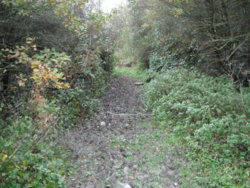
There was a bridge here, Honest!!
I'll bet that at least 40& of the local residents don't know it's there (or was...)I
It's a lot drier than it normally is< it was part of one of my cross-country routes, when I was running (1)
510235


510236


https://www.geograph.org.uk/photo/3406198

They may know of the other one, that spanned New Road (B6133) by the 'Cross Keys' pub
https://www.geograph.org.uk/photo/2590247
Or maybe regard it as a wall?

This bridge was by the N of Snydale Branch
https://maps.nls.uk/geo/explore/#zoom=17&lat=53.68687&lon=-1.39000&layers=168&b=1


1. 2014 XC
510240 510241
 
Top Bottom