Your bike on a bridge pics

Page may contain affiliate links. Please see terms for details.
D

Deleted member 26715

Guest
About to cross a dyke on a Bridleway just outside Scrooby in Nottinghamshire, maybe we need a new category MBIFO an obstruction. How you are supposed to be able to get a horse through there is beyond me.

IMG_20190901_112334.jpg
 
I used the search, but can't find this one used already (or a previously taken photograph)
Circa 12:30, today

Aire & Calder Navigation Canal
Between 'Stanley Ferry'(1 & 2) & Birkwood Lock

It's a bridge. spanning a stream, that passes under the Canal

I'll call it a bridge, as it has parapets
A culvert would not have them?


DSCF0180.JPG


https://www.geograph.org.uk/photo/1843521
https://www.geograph.org.uk/photo/1843528


1. Where there's a magnificent 'Bow-String aquaduct, carrying the 'A&CNC' over the River Calder
Plus, the British Waterways workshops, where most lock-gates, for the north of England are made

2. The aquaduct, & workshops are just to the other side of the bridge, in the background
(my usual route to, & home from, work)
 
Last edited:
Can we have under the bridge??
Circa 12:40, today

Birkwood Bridge
Aire & Calder Navigation Canal
Approaching Birkwood Lock, from 'Stanley Ferry

DSCF0181.JPG


The bridge is 'full-width', & would cope with 2-way traffic, but is just an occupation bridge, & also gives access to the Lock-Keepers house
It was built to this width, as there's no alterations/signs of widening the abutments

https://www.geograph.org.uk/photo/1843535
 
Last edited:
The 'Trash Screen Bridge' at Stanley Ferry
Crossing the River Calder, & adjacent to the 2 aquaducts, taking the Aire & Calder Navigation Canal over it
There's a fair amount of water in it, due to the weeks heavy rain

487069


487070


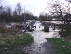
I was riding back from watching the start of the mens race, from Leeds today, when I saw the water levels under the road bridge, & detoured a few dozen yards onto the bridge

Normal water levels, as seen from the 'new' aquaduct; https://www.geograph.org.uk/photo/4907910


It can get substantially higher, this was 26th December 2015, the same day that Tadcaster Bridge collapsed
487067


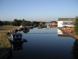
This is a more usual view, with the 2 aquaducts, & the 'Trash Screen' to the left of shot
If you could see it, that it, but it's inline with the tent, from my viewpoint
487068
 

EltonFrog

Legendary Member
My bike on a bridge on the Thames path yesterday, with a railway bridge in the background.
487156
 
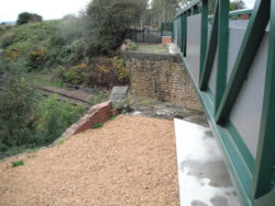
On the new cycle-path/bridleway/footpath at Whitwood Junction

(ex) Lancashire & Yorkshire Railway (Methley Branch), which is what it was built as

The 'line' was from Cutsyke, up to Methley, & intersected the Midland Railways Normanton - Leeds line at Pinders Bridge
Plus a branch ran off towards Lofthouse, via Stanley (the Great Northern, North Eastern & Lancashire & Yorkshire Railway Joint Branch)

488028


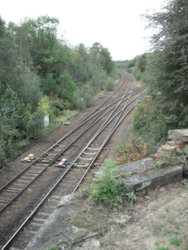
Looking down the side
488029


Castleford behind me
Normanton & Wakefield KirkGate, to the left
Woodlesford & Leeds, to the right
488030

It's been built where the blue circle is, in the map below the photograph;
https://www.geograph.org.uk/photo/5651831
 
Last edited:
Top Bottom