OK, I went and took a look last night. I didn't have time to cycle it before Norwich Cycling Campaign's AGM and it was raining afterwards so I went straight home instead.
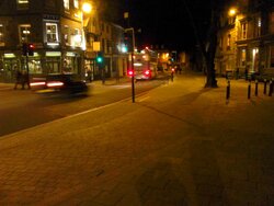
Here it is. It was very quiet on the road by 7pm, much quieter than I remember it - probably because you cannot enter the city centre from St Stephens or St Giles any more, and by the time you've driven around to St Benedicts, you might as well keep on using the inner ring road rather than drive along it, Charing Cross, St Andrews and up to Anglia House and back, with all its traffic lights.
As it was quiet, most cyclists I saw preferred to use the smooth new tarmac instead. I got bored waiting for a cyclist to use the track!

Now that is a piece of art, a hidden cycle path with a beach thrown in. How abstract.
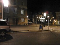
The sand is only around the cycle parking stands and the bottoms of the stands are visible, so I'm wondering if it's going to be paved at a level between cycle track and footway. Given the vociferous abuse in the local media, I'm not surprised if they've chosen to open it when there's still some work to finish in less-used areas.
I can't think of a worse surface to cycle on, block paviers must be the worst surface for grip in the wet short of cobblestones.

They're not block paviers as I understand them (like we have on some streets in King's Lynn) but more a sort of smoothly-abutting mini paving slabs - except for where it joins the road or the footway crosses it, where they do feel like paviers. I'm not sure about grip either, but they're probably going to be better than the cobbled slope of Princes Street.
I think it is too subtle. Most people were walking on it, apparently unaware it's a cycle track. Norwich has form for this, with this camouflaged cycle track on the north end of St Peters Street:

because, you know, colouring the surface red would look ugly when you're taking a photo of the 1930s City Hall uphill and can't see it.

The main failure of that one is that many people seem to fail to spot the right turn into Upper Goat Lane and continue cycling contraflow out of St Giles, which is prohibited on that stretch.
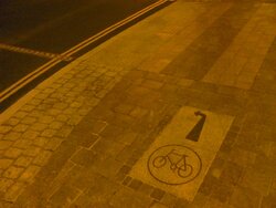
My suspicions about the Palace Street end are correct. There's this far-too-subtle paving slab sign for eastbound traffic, telling you to ride out into traffic. At a glance, I think you could easily mistake the non-regulation arrow for a "straight ahead" one and find yourself salmoning along the cycle lane:

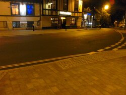
I spotted two changes from the consultation design: firstly, the south end of the track is a bit of a sweeping bend and should cause less conflict that merging back into the carriageway blind; secondly, there's this little filter/escape lane if you're coming from Wensum Street and want to use the cycle-only traffic light to continue uphill into Princes Street:

As far as I could tell without riding it, the surface seems flat/smooth (as much as paving slabs ever are) and the kerbs feel flush, which Norfolk usually fails to do. It's early days but hopefully at this price, they won't settle unevenly!
There are some videos coming from Norwich Cycling Campaign about the Pink Pedalway - one was previewed at the AGM and I'll post it once it's finished and uploaded somewhere. While Tombland is a lot of money for not much, there's worse elsewhere IMO and it has to be seen to be believed.


 The main failure of that one is that many people seem to fail to spot the right turn into Upper Goat Lane and continue cycling contraflow out of St Giles, which is prohibited on that stretch.

