ColinJ
Puzzle game procrastinator!
- Location
- Todmorden - Yorks/Lancs border
If yes, still there or demolished?
2018:
March 2022 (top section already gone):
If yes, still there or demolished?
...
Point of order...
Ok, it isn't a railway NOW but the cycle path to Glasson Dock follows the course of a dismantled railway line!


I didn't mean the lane - I meant the embankment in the distance which the railway ran along (or behind), which is what @BrumJim asked about.That lane has always been a lane and was never part of the old railway.
Trying to work out if the ridge in the distance is a ditch or a railway
I didn't mean the lane - I meant the embankment in the distance which the railway ran along (or behind), which is what @BrumJim asked about.
That looks like the base of a wind turbine on the right of the picture. There are only about 1,500 onshore windfarms in the UK, so that narrows it down a bit!

I anticipated that you would say that...that's a dyke, part of our flood defences.
The embankment was probably to keep floodwaters from the Lune back so it could be argued that the fact that there also used to be a railway has nothing to do with it!

The embankment was probably to keep floodwaters from the Lune back so it could be argued that the fact that there also used to be a railway has nothing to do with it!


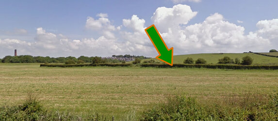
there used to be a railway, but... the only evidence of it in this challenge is this hedge:
View attachment 668907
the dyke/long lump thing, i believe, came long after the railway was axed.
Don't keep us all in suspense then...!OMG I KNOW A ROAD !
Although calling it a road is a bit generous...

It's the NCN 5 across the Frodsham Marshes. First did it on a 25mm race bike and my pals cursed me for that. Just the one flat.Don't keep us all in suspense then...!
It's the NCN 5 across the Frodsham Marshes. First did it on a 25mm race bike and my pals cursed me for that. Just the one flat.
Went back about 5 years later on a gravelbike - bit better but I felt sorry for the poor lady on her purple brompton I met riding it.
The runway at Port Stanley was smoother in the 80s.
View attachment 668910

OK go gently with me - this is my first time. I'm sure there's enough clues in here ?
View attachment 668928

